Lee's Lookout
Revised 20260116
31.8779833°, -106.5002887° 5,525' MSL
Minimum Required Rating P4
Wind Strength (MPH)
Minimum 5, Ideal 10, Max 12, Gust 5
Launch Faces 250°
Synoptic Wind Direction (Degrees)
Ideal: Left 240 Right 260
OK: Left 235 Right 265
Minimum Required Glide Ratio to bail out LZ: 7.6
When flown during thermic times/dates, TURB recommended
Bail LZ's: 31.871923° -106.507787° , 31.882664° -106.507055° (When not going XC, which is preferred) )
THE RGSA DOES NOT RECOMMEND FLYING LEE'S LOOKOUT DUE TO MESQUITE GROWING ON THE LAUNCH. WE SUGGEST GOING TO NELSON'S LAUNCH. THE RGSA NO LONGER HAS PLANS TO RE-OPEN LEE'S LOOKOUT.
THE FOLLOWING INFORMATION IS FOR HISTORICAL PURPOSES AND TO HONOR THE MEMORY OF LEE BOONE.
Site Protocols / Rules
All pilots must register with the Franklin Mountain State Park authorities before flying in the FMSP. Texas Parks and Wildlife requires current USHPA membership. Pilots are permitted to launch from and land anywhere within the boundaries of the FMSP, including paved roads. Visiting pilots must obtain an orientation from an experienced local pilot because of the sensitive relationship with the Franklin Mountains State Park. Contact the RGSA.Do not forget to notify the Park before launching and after landing. Send a text message ONLY to (915) 539-0558 before launching and just after landing e.g. "John Doe launching from (site)" and "John Doe landed", respectively.
Key Site Safety Information:
Tiny launch with slippery footing. Outcroppings below must be avoided. Proximity to the Dragon's Mouth means more turbulence than FC. It is a very tight launch area – less than 10 yd. on each side. There is a shear cliff just north of launch. You can be blown over the back or sucked into the Dragon's Mouth. There are numerous desert plants in the vicinity of the launch area that can snag the pilot/glider.
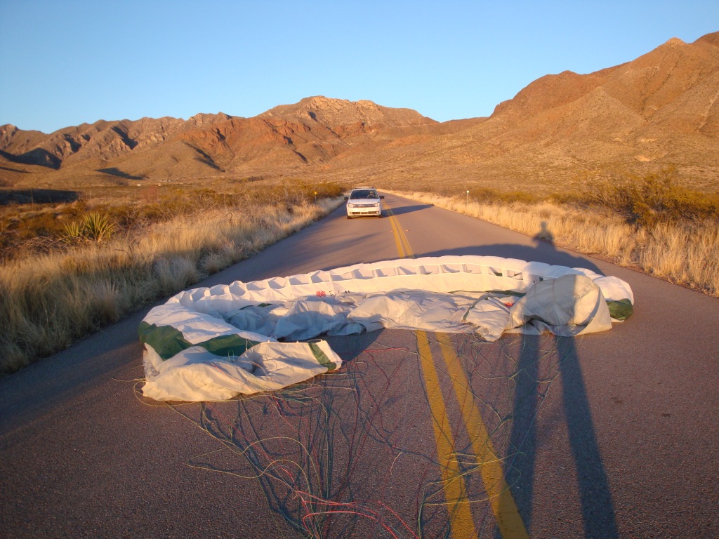
Be extremely careful of getting sucked into the DM. It is unlikely to happen if you check the wind velocity at the Pass before you hike up. If it's blowing more than 12 at the Pass, be extremely careful when launching – go straight out and keep left of the ridge in front. Better yet, pack up and launch from Agave. Landing on the highway is not only illegal but dangerous.
Power lines go east – west along the side of the canyon to the south of launch. They are almost invisible. Make sure that you get a few hundred over launch before you head south and up. In general – STAY AWAY FROM THE SOUTH SIDE OF THE CANYON NEXT TO LAUNCH UNLESS YOU ARE HIGHER THAN THE RIDGE BEHIND. The power lines, fortunately, turn south after leaving the canyon and the poles are easily visible. As of 1/17/2026 the lines were not energized.
General Info
Prior to developing Nelson's, Lee's Lookout was one of our better west-facing
sites for flying in the Franklin Mountains State Park. It is named
after the discoverer of the site, the late, great Lee Boone - killed flying his Aerotrike Cobra powered Hang glider on April 1, 2023 near Santa Theresa NM. We miss you Lee! His obituary. PDF version
Originally it was a
vertical (12) minute hike from the Transmountain Pass highway (SR #375), but the TPWD no longer permits hiking up from the top picnic area, ALL ACCESS MUST BE FROM THE RON COLEMAN TRAIL.
Lee's Lookout might be considered when:
1.) You want to honor Lee Boone by flying his launch instead of Nelson's.
2.) It is too weak to launch from
Agave.
3.) Wind direction at Santa Teresa (the National Weather Service location in our region) is west to southwest (PG only).
PG pilots should not launch if winds are northwest – the site is too small to safely inflate a glider with this wind direction. If winds at the surface are west/southwest and greater than 8-10, launching from Agave is much safer. Minimum wind speed depends on the pilot's skill. 3-8 mph will work just fine as the site is thermic. If you can do the 50 minute hike to Nelson's, go there. Lee's Lookout has the advantage of being just above the daily inversion which reaches about 5,000' MSL. It will have sufficient air to launch when Agave is calm. Its proximity to the Dragons Mouth (DM) ensures that any west component in the wind will be almost southwest at launch due to the strong venturi at DM which makes launch easier when conditions are weak everywhere else. Launch is tight (10 yd. x 10 yd.). If PG pilots walk down the steep slope a ways and lay their wing out near the edge, inflation is easier. The downside is that the pilot cannot see his lines until the glider comes up – someone helping can help scan them.
Pilots should always launch to the left (facing almost SSW) and follow the ridge out. The stronger the conditions, the more the pilot will ascend immediately after launch. In weaker conditions, he may have to follow the ridge out and hunt for thermals – there are always plenty of them. Remember that the geography of Lee's Lookout ensures that winds at launch will be from the south (strong conditions) or southwest (weaker conditions) because of the venturi at DM. That is, if winds at Santa Teresa are west, the winds at launch will be southwest or south.
The northwest portion of the site can be very thermic due to its dark color and west face, even at the end of the day. But as the pilot is launching to the south (and left), it is safe to launch during a lull as the thermals moving up the northwest part of the site will not affect the air out in front to the left. When winds are west to southwest miles out front, the venturi of the DM causes the air to swirl around the ridge and up the northwest part of the launch area triggering thermals in the process. Accordingly, the air to the south or left will be smooth all the way out if, for example, it is late in the day. Otherwise, thermal strength out front will be the same as elsewhere in the range. The weaker the conditions, the less pronounced this effect is. This has been proven many times by actual flights from the site.
LZ
The best landing option is a mini-XC to the Tom Mays Park entrance 2.6 miles NW of launch. It is somewhat easier for PG pilots to land on the Tom Mays access road east of the gate as they can set up a mile away. As there are often thermals popping off everywhere around the roads, using the access road east of the gate allows for plenty of margin. The access road slopes down for a half a mile and is clear on both sides. If there are cars on the road, just land in the bushes on the south side of the road. You may have to spend some time picking your lines out of them but consider what an amazing flight you just had.
Landing in the desert is often more complicated than coastal or other inland sites because of the very hot ground at the surface (+140°F in the summer) which causes small but powerful thermals to pop off near the surface. They can dramatically change where you land.
The LZ near the entrance of Tom Mays Park. The access road faces
SW and is a 1/2-mile-long so pilots can relax and setup without worry if
they encounter thermals while landing. The vehicle in the photo
stopped and waited for the pilot to get out of the way.
Bail LZ Info
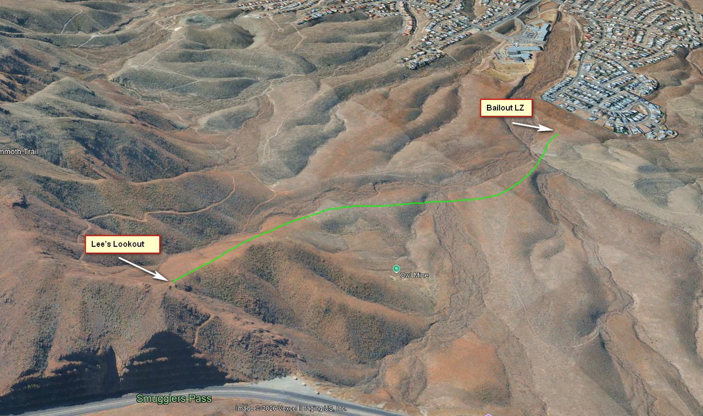
If you do a sled ride from launch, just follow the ridge straight out, head for the dirt road that goes from the top of the ridge down the canyon to a housing development. The bail out LZ is at the end of the dirt road 100m before the wall of the housing development.
Historical Info/Media
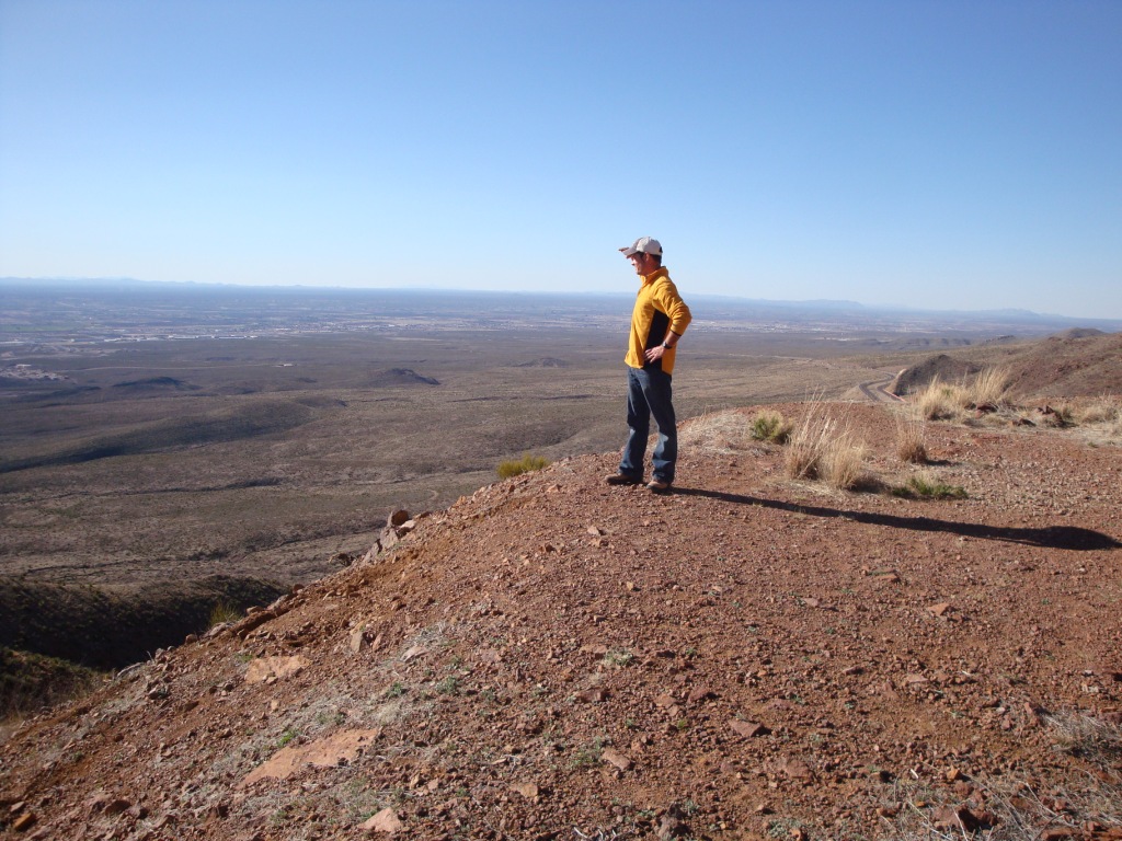
The late Lee Boone surveying conditions.

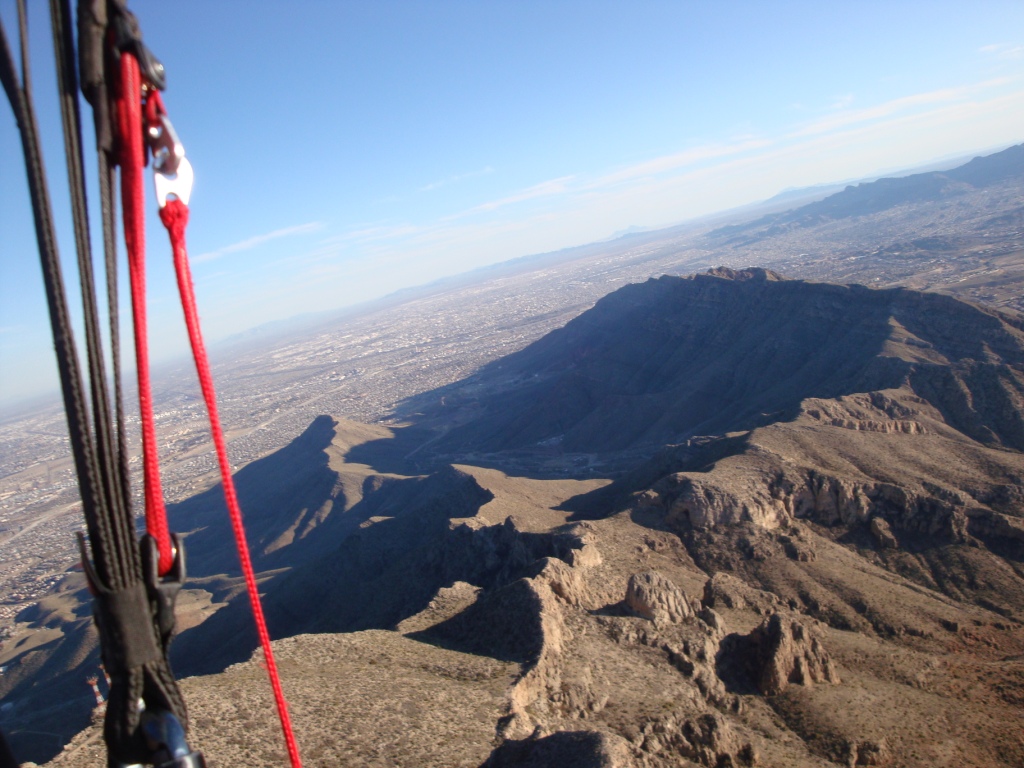
Hadley Robinson enjoying the air high over South Franklin after launching from Lee's Launch .View of South Mt. Franklin (Radio Peak) after a successful trip up from
Lee's Lookout. From here, this pilot went over 1,000' above the
top of the range.
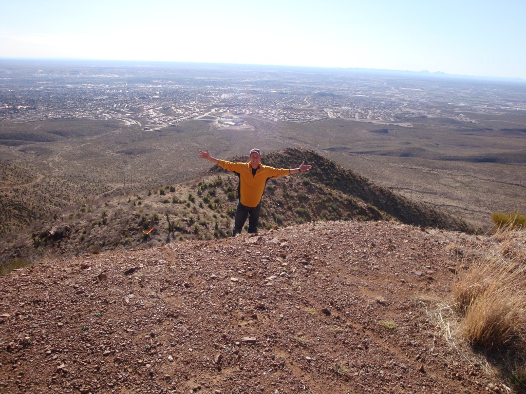
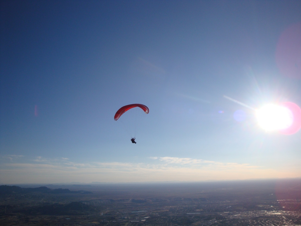
View 1/2 mile above and just south of launch. From here a pilot can
fly all the way to the end of the range. HG pilot Dick Moody once flew
from here to Ascarate Park many years ago.
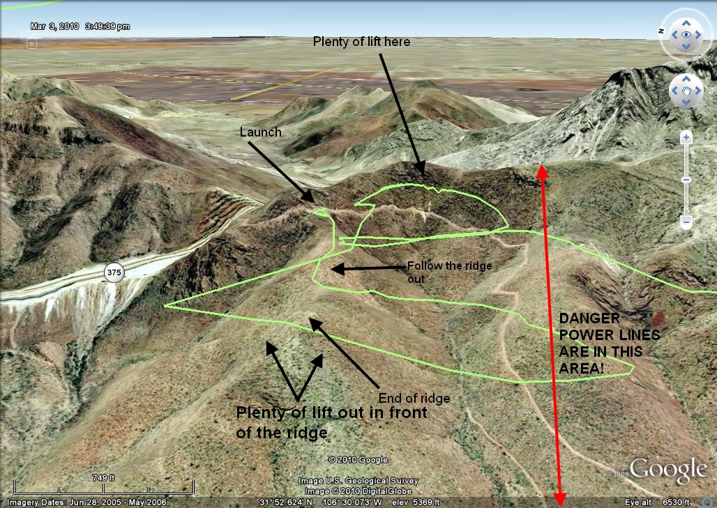
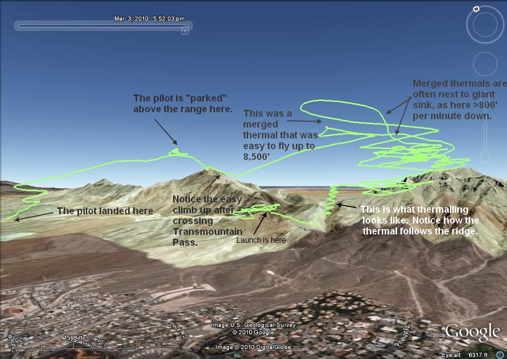
When launching, follow the top of the ridge out. At the end there is plenty of lift with thermals galore popping off the power lines at the base of the mountain. (The poles can just be seen near the dirt road.) If you launch at the right time of the cycle, you will get in strong lift right at launch and go straight up. You should always turn left, bench up the ridge behind launch, and get high enough to safely pass over the power lines. Follow the ridge south until you get to S. Mt. Franklin and work your way up via thermals and ridge lift. It's an easy task for most pilots. Then you are in the magic airspace above the range and can fly for hours in any direction. Here is info on safely flying in the Franklins once you are above launch.
Lee Boone (photo below) is standing about where a PG pilot should launch
from.
Lee Boone parked in front of the Franklins above Lee's Lookout at 7,500'.
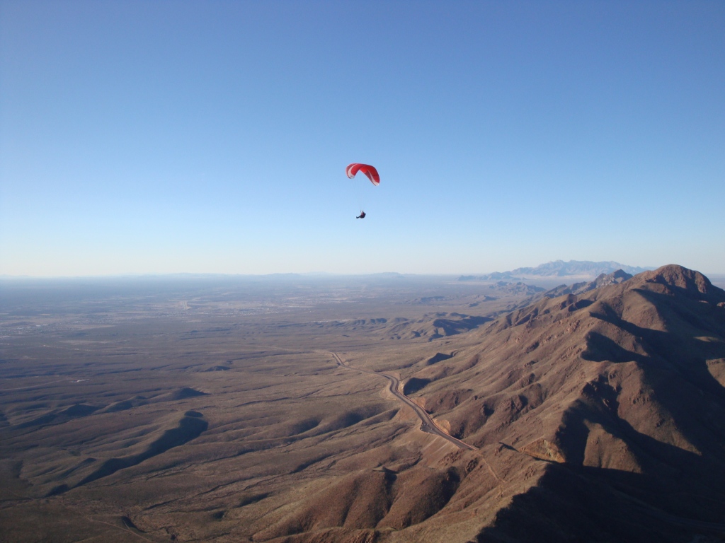
Lift is everywhere....
A typical flight from Lee's Lookout. Most P3
pilots should be able to do this without any trouble.
Lee Boone soars above the range in the amazing lift that is above
the Franklins. Lift is everywhere once you pass 7,000'. This was
his first flight from Lee's Lookout and he had no trouble benching up.
Pilots can soar the length of the Franklin Mountains.