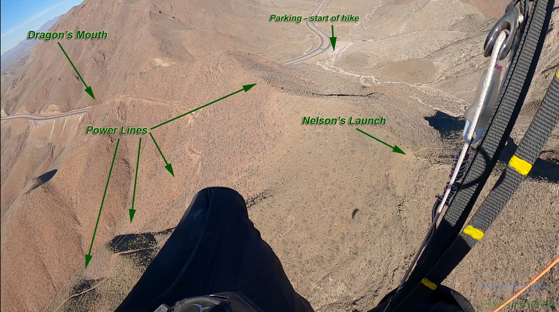
Nelson's Launch
Revised 20260116
31.872852° -106.498522° 5,750' MSL
Bail LZ: 31.871923° -106.507787° , 31.882664° -106.507055° (When not going XC, which is very common :) )
Minimum Required Rating P3
Wind Strength (MPH)
Minimum 5, Ideal 10, Max 13, Gust 5
Launch Faces 272°
Synoptic Wind Direction (Degrees)
Ideal: Left 230 Right 290
OK: Left 200 Right 300
Minimum Required Glide Ratio to bail out LZ: 5.3
When flown during thermic times/dates, TURB recommended
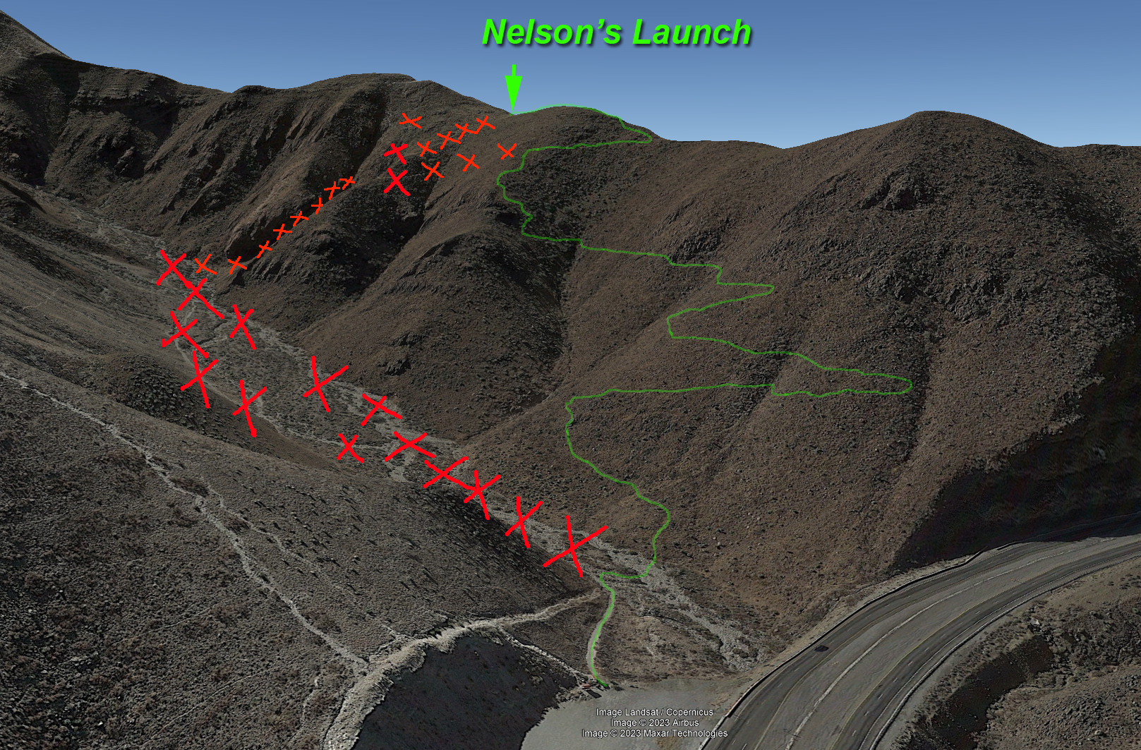
Note: Nelson's is open! Finally! Hooray! Please be aware there is a new trail as of Spring 2023. The old trail, which went up the middle of the valley is CLOSED. See the map below for a depiction of the new trail. The new trail is wonderful, it is a veritable superhighway. Enjoy!
Site Protocols / Rules
All pilots must register with the Franklin Mountain State Park authorities before flying in the FMSP. Texas Parks and Wildlife requires current USHPA membership. Pilots are permitted to launch from and land anywhere within the boundaries of the FMSP, including paved roads. Visiting pilots must obtain an orientation from an experienced local pilot because of the sensitive relationship with the Franklin Mountains State Park. Contact
the RGSA.
Do not forget to notify the Park before launching and after landing. Send a text message ONLY to (915) 539-0558 before launching and just after landing e.g. "John Doe launching from (site)" and "John Doe landed", respectively.
Key Site Safety Information:
Nelson’s requires moderate to advanced launching / active piloting / turbulence skills, depending on the time of year, time of day, and conditions. Mid-day spring air could be very spicy. Winter late afternoon soaring can be glassy smooth. The launch is very snaggy and broken lines are common. Landing in the desert below launch can be tricky, even though there is a reasonably nice cleared bailout LZ. There is a venturi effect at launch that can pluck you if the wind is more than 10 mph. Actual winds at launch are always higher than the forecast synoptic winds, but the gully below launch works to pilots advantage because it can channel cross synoptic winds straighter up the slope.
DO NOT attempt to land in the valley east of launch, or in the trailhead parking lot. Very, very bad rotor. Do not fly this site without a functioning speed system!! Do not get caught low in the gully in front of launch. There can be considerable hiker traffic, so the pilot must stay focused. Hikers can arrive with no idea
that a launch is about to occur.
The terrain out front can present many hazards, due to the convoluted topography. Pilots must use caution and fly conservatively, avoid scratching and stay high above the gullies and
canyons!
There are power lines about 150 meters to the north, that turn south as they run down the slope to the west. Even though as of 2026 they are not energized, stay well away from them – always consider what could happen if you experience a deflation or
have to throw your reserve above power lines.
Do not venture into the valley to the east, it is filled with death-air rotor that is almost guaranteed to hurt you badly – not to mention the nearly invisible power lines that run across
it . Heading south should also be approached with caution; although it is possible to fly all the way to the southern end of the Franklins and
back, the topography is more convoluted than to the north and pilots have experienced deflations in the area to the west of Gunsight Notch aka “The Mammoth.”
General Info
If you want to go big in the FMSP, this is the launch to use.Nelson's Launch was pioneered by Steve Crye in 2016, when, after remembering from his previous hiking experience on the Ron Coleman trail, there was a flat, fairly smooth spot where the trail from the valley meets the ridge to South Franklin Peak. He hiked with his kit and was able to launch! A good rule of thumb for is to take a wind reading at the top of Transmountain Road from the picnic area – if you measure more than 9 mph there consider heading to Agave. Nelson's works best on days with very light synoptic winds from the west, and winds aloft up to 10k less than 8 mph.
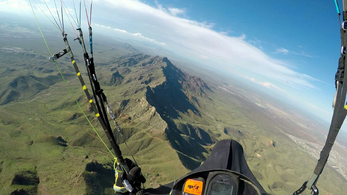
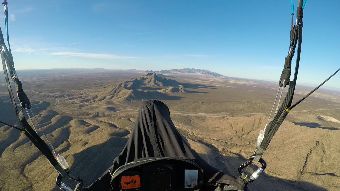
Getting high over the Franklins. View North. Frame Grab by Steve Crye
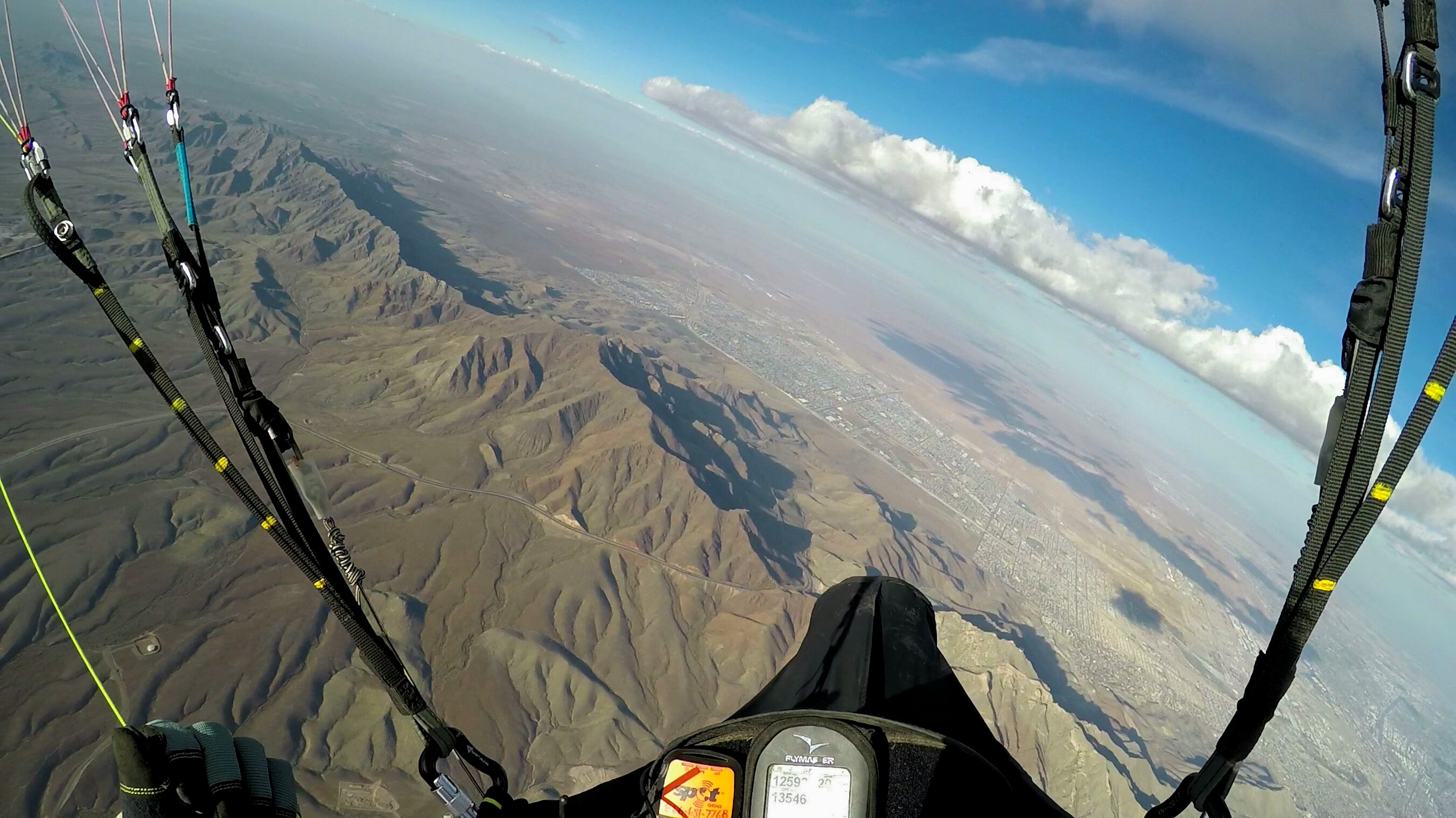
XC from Nelson's to Santa Theresa. South Franklin Peak is just to the right of the pod. Frame Grab at 13,500' by Steve Crye.
LZ
Your best bet is to go XC and find something smooth and free from cactus miles away. The "Milk Run" is to fly to the main Park headquarters (Tom Mays unit), after getting up to about 6500' MSL before crossing the Dragon's Mouth. If you sink out, pick the flattest, least cactus infested location on the plains below. There is an area relatively free of ocotillo and agave just to the east of the housing development along the old jeep trail - the glide ratio to this spot is about 5.3:1. Do not land in the suburbs.
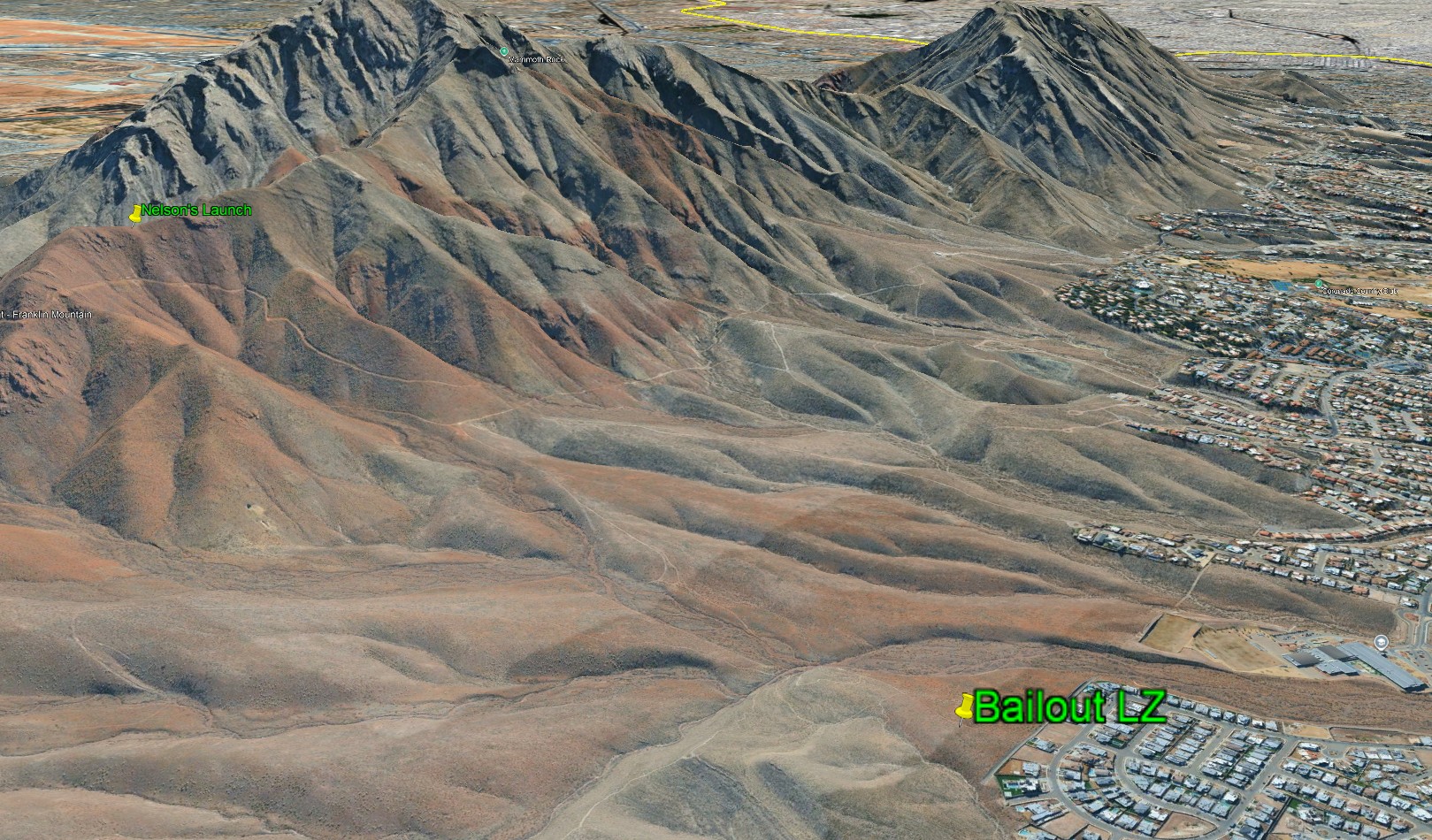
Nelson's and Bailout LZ
If you land just before or after sunset, be cautious of the katabatic flow that comes down the mountains. It can be just 20' thick going west and the air just above it can be moving east.
Directions to launch
The new, beautiful trail is marked in green below. DO NOT USE THE OLD TRAIL! The new trail crosses the wash early and is 100% on the east-facing slope to the west of the bottom of the valley.
From the Ron Coleman trailhead at the parking lot, the hike to launch will take anywhere from 25 to 60 minutes depending on your level of conditioning. Please stay on the trail, look for the aluminum medallions that mark the trail.
Launching
The wing can come up fast during inflation because the layout area does not see the full strength of the wind. Use caution in anything higher than 10 mph, because that will generate significant rotor just 15 feet back from the point where the layout area transitions to the slope. Stand downhill and position your wing just at the top of the slope, and even then the wing will come up fast and you might be plucked; be ready to check the surge and keep a cool head. We strongly recommend that pilots use the Mitsos Technique (A’s and rear risers) and be prepared to abort the launch at any time prior to turning to face into the wind. Abort does not mean bury the brakes! De-power your wing with the rear risers. Before flying, if possible, forward kite for a few seconds to be certain everything is under control. Please take the time to remove some rocks from the runway slope below the pilot’s stance each time you visit, if we all pitch in we can make it smoother and safer!
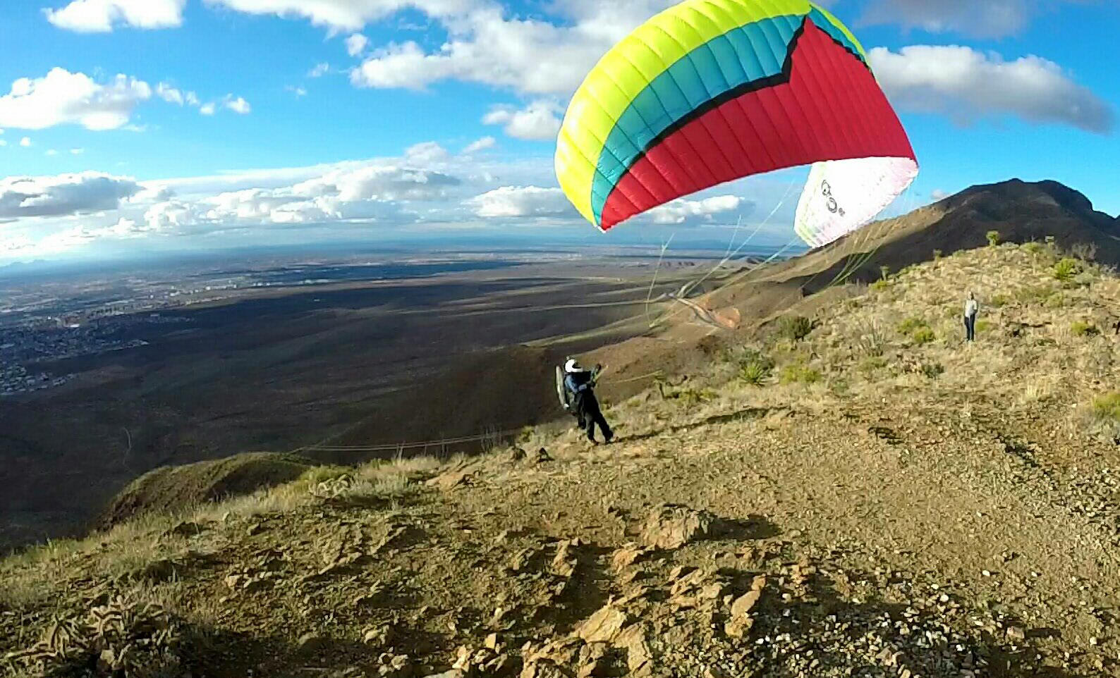
Launching in ideal conditions - about 7 mph, synoptic wind from due west. Photo by Hadley Robinson.
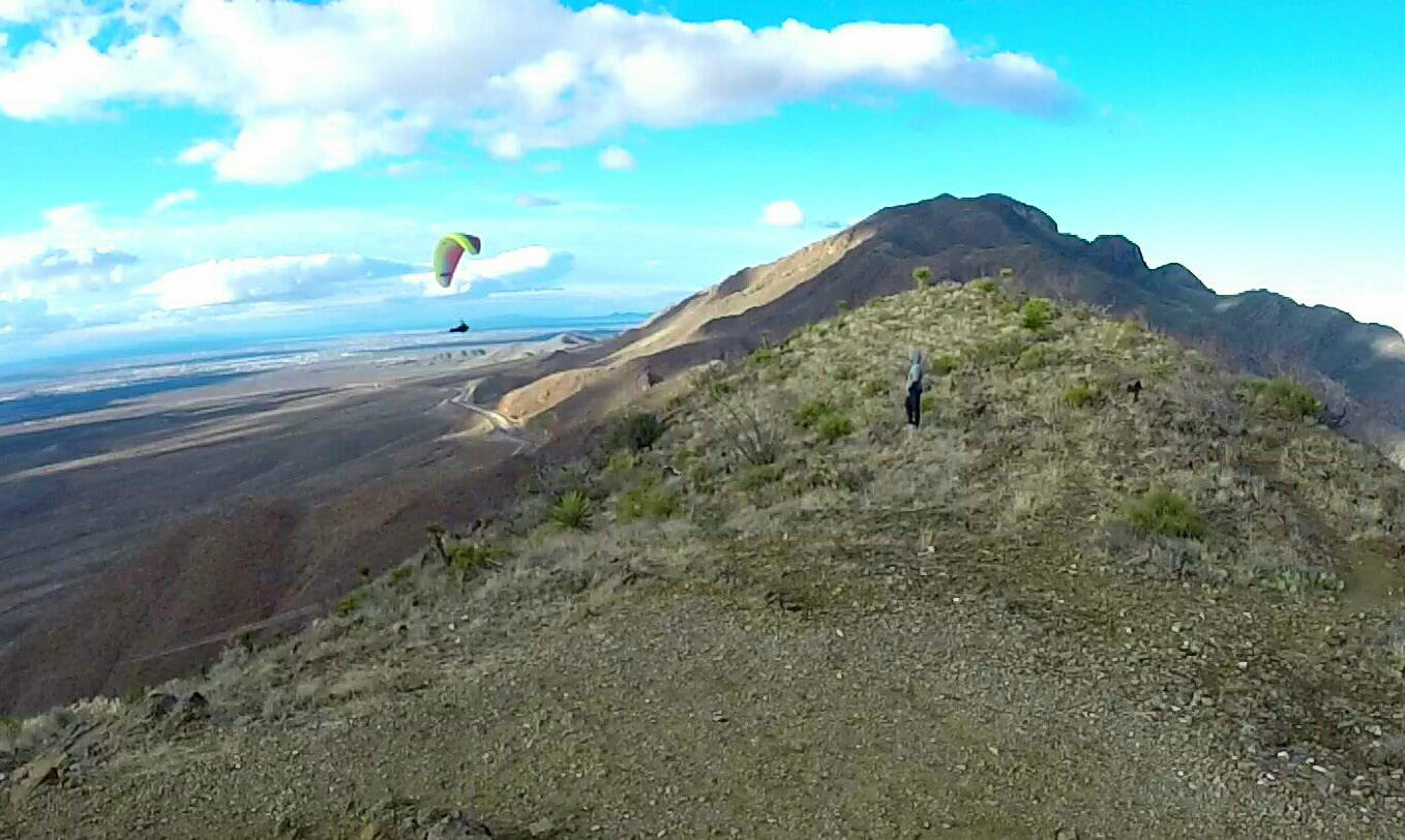
Immediately after launch fly to the right (north) and work the ridge between launch and the small hill south of the power lines. At any time you get more than 50' below launch, head out and look for thermals. It is far better to head west early than to scratch (ask us how we know ...) Don't below and alone hoping for a low save - head out as soon as you are sinking below launch - this will increase your chances of finding a thermal and getting up! Pilots have ridden these thermals all the way back up, thousands of feet over the ridge.
Winds and Conditions
It is important to note that overhead disturbances, thermal activity, and the Jet Stream can greatly affect our flying in the Franklin mountains. Thermals and atmospheric disturbances can cause the Jet to mix down to the surface and cause dangerous sheer turbulence. If you see any gusting in the hourly forecasts or the Jet is overhead, use extreme caution. It is possible to fly Nelson's on days with the Jet overhead, provided the winds at 8000' and below are less than 15 mph.
Although Nelson's is flyable with synoptic winds anywhere from 220° to 300° (measured from the NWS station at Santa Theresa airport ), keep in mind that winds at launch will appear to be westerly even though they might be more southerly or northerly. Best synoptic winds are from 250° - 280° at 7 - 11 mph average at 6000'. On summer days, with calm or very light synoptic winds, the conditions at launch are excellent in the late afternoon due to upslope flow from solar heating.
When the wind is above 12 mph and more southerly than 240°, and particularly when thermals are present, anytime the pilot is at or below launch, there is a very real possibility of encountering turbulence strong enough to cause deflations, or sudden sink that can force the pilot into contact with terrain. When the wind is more southerly than 240°, do not fly south of launch until well above the ridge to the south, and always be ready to deal with a deflation. Remember: This is the desert and air during mid day, especially during the summer months, can be challenging. Less experienced pilots should stick to the early AM or late PM outside the late fall and winter months. Laminar air is almost always present late in the day and dreamboat soaring in the Franklins occurs at that time. Thermals can be gigantic and sharp-edged here, as in the Owens Valley. Always check the weather or with us before flying.
Winds Aloft
Check winds aloft before arriving at launch. There is a weather station at the top of South Franklin (6614') that sometimes has reliable data:
https://mesowest.utah.edu/cgi-bin/droman/meso_base.cgi?stn=F4547
Look at Windy.com, and XCskies if you have a subscription. If the forecast shows over 15 mph at 6400', do not fly as you can get blown over the
top of the range which would not be fun ...The presence of the
Dragon’s Mouth to the north always affects the winds at launch, causing a SW component even if the winds at Santa Theresa are from the NW. If winds aloft are more southerly than ideal (less than 230°) use extra caution to stay away from the lee (north) sides of the ridges.
You will not enjoy flying the Franklins if winds aloft are faster than your glider's top speed. Katabatic flow down the mountains begins at dusk and makes landing more difficult as the pilot will be landing in a weak downwind = higher ground speed with the possibility of air just above going the opposite direction. Be READY for this if you plan to fly late. This daily flow is often strong enough to overcome the prevailing wind. This means that the pilot will be flying in air going the opposite direction as he descends below about 300' AGL. Above this altitude, the winds may still be strong enough to keep the pilot in ridge lift.
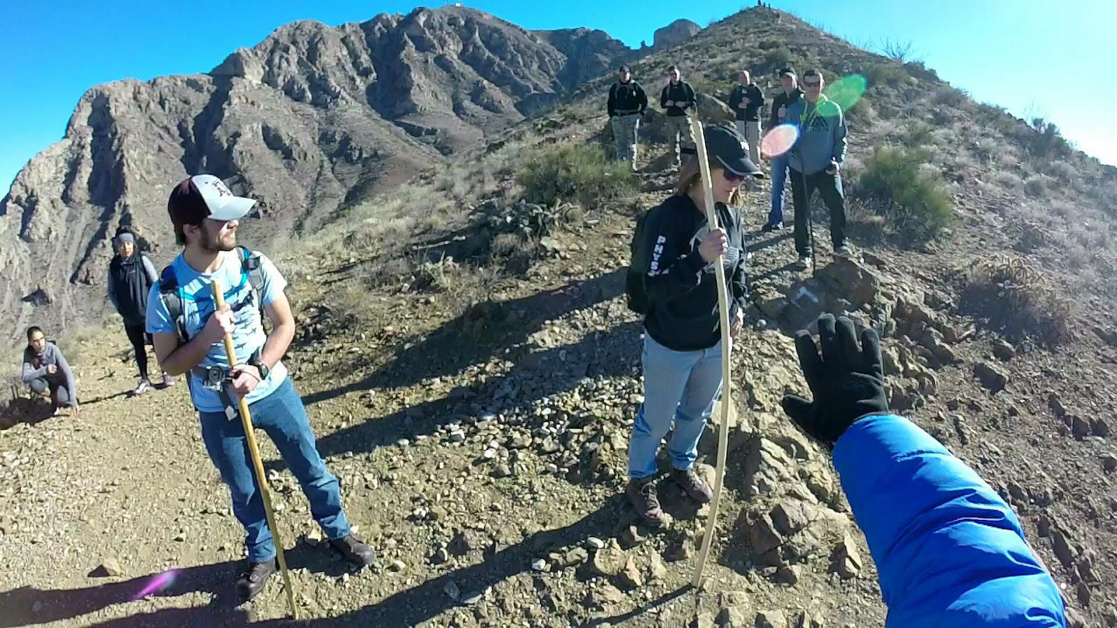
This is a frame grab from GoPro video shot during the 1st launch from Nelson's. This is a popular trail with considerable traffic.
The Franklin Mountains present exciting and challenging flying, especially for ridge and thermal soaring. Because of direct solar exposure to the west and with no other mountain ranges out front, the range has excellent soaring. On good summer and fall days, an intermediate pilot can easily soar over 1,500' higher than the highest peak. However, check the winds aloft and the Jet Stream forecast; an ideal day has no Jet overhead and no more than 15 mph at 8000’.
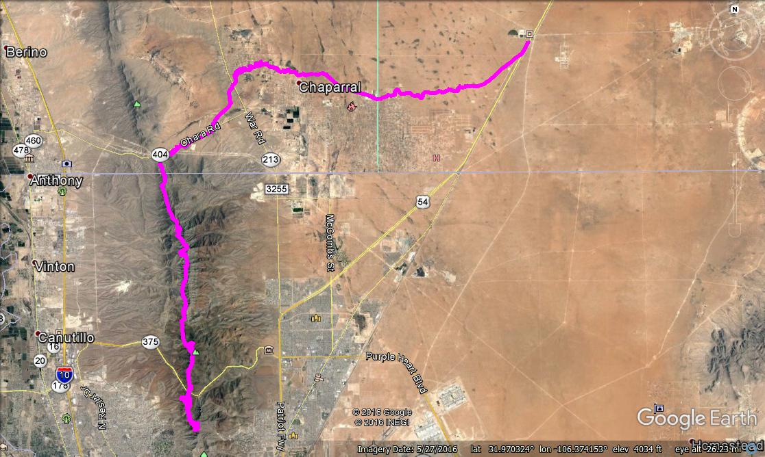
Below are the tracks of Max Montgomery's record XC flight March 5, 2017 from Nelson's to the Otero County Processing Center (jail) on Hwy 54. The distance was about 20 miles. He is the first to get to Anthony's Gap and then go east. Click on this KMZ to view or download it in Google Earth.
The shopping centers, parking lots, and industrial buildings west of FMSP are a constant source of thermals that drift into the mountains. These thermals, combined with ridge lift, help make FMSP such an amazing place to fly.
Be sure you have a GPS/vario that can show your ground speed – you must always know your speed over the ground. At slow speeds you may be going forward or backward – make sure you know which. Altitude at launch, unlike Agave, is usually above the top of the daily inversion which covers the Rio Grande valley, but there will still be cycles, so time your launch to take advantage of a cycle. We do not recommend benching up if you must use speedbar to stay out in front. Don't risk being blown over the back.
Benching up
After you gain a few hundred feet over launch you can extend the your soaring to the north and the south. Stay away from the venturi at the Dragon's Mouth aka Transmountain Pass unless you are at > 6500’, roughly level with Secret Hill. Crossing to the north of DM will let you access the highest part of the range, just use caution as you cross the DM and be prepared to turn away and back south toward launch if you encounter turbulence or start to get sucked to the east – that means you are too low and not far enough out in front; re-group to the southwest, gain some altitude and try again. See the information on the Agave Hill page regarding the Dragon’s Mouth (about 3/4's down the page).
On a good day, after the pilot gains 300’ over launch, the lift can be widespread and extend both well out front and slightly east of the ridge. It is possible to soar the entire length of the Franklin Mountains from Nelsons: Ozone Alpina 3 - XC, Franklin Mountains
Most flight from Nelson's are not that epic, but it is a great, consistent site for both thermalling and ridge-soaring: Ozone GEO 5 - 10,800' MSL above Franklin Mountains from Nelson's Launch
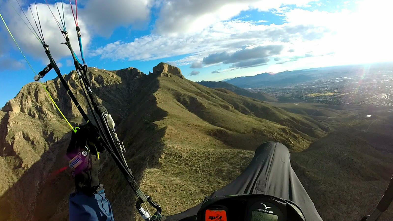
Steve Crye cruising north along the top of the Franklins on his way to Anthony Gap and east. (To view his flight in Google Earth, right click on this
KMZ, save it to your desktop, and open it with GE.)
View South:
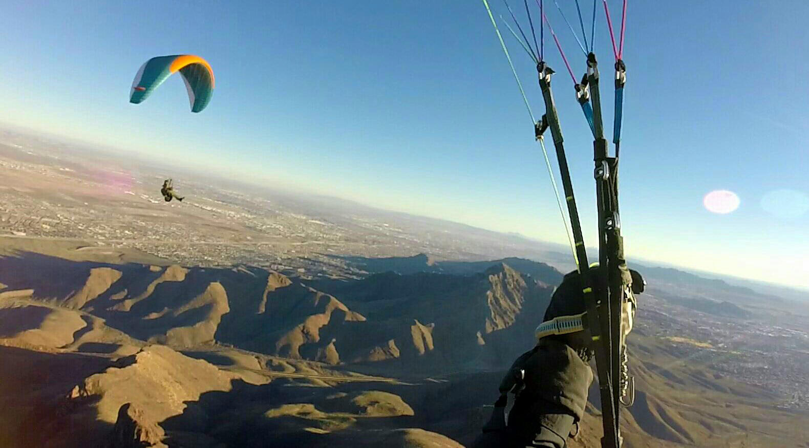
Max Mongomery enjoying the air near N. Franklin at 8000’ after launching from Nelson's:
Going over the Back
If you unintentionally go over the back of the range, head northeast or you will fly into the controlled airspace (Class C) of El Paso International Airport that begins at the north/south Patriot Freeway (Hwy 54). If you are going over the back despite all your efforts to descend, get as high in lift as you can, turn downwind and fly at best glide (use your vario and know your wing to determine the ideal amount of bar or brake for the conditions). If you can, stay out of the controlled airspace. Land anywhere safe as far away as possible from the mountains. Your ground crew or other pilots will call the airport if you must land in controlled airspace and notify them of the emergency so don't worry about that – just land safely. However, this event will never occur if you check winds aloft BEFORE flying!