North Mount Franklin
Revised 20260116
31.902917° -106.493700° 7,152' MSL
LZ 31.910659° -106.519001° and 31.876146° -106.519084°
Bail LZ's: PG/HG 31.871923° -106.507787° PG only 31.882664° -106.507055°
Minimum Required Rating P3
Wind Strength (MPH)
Minimum 4, Ideal 8, Max 12, Gust 4
Launch Faces all directions
Synoptic Wind Direction (Degrees)
Ideal: Left 240 Right 270
OK: Left 1 Right 359 (all directions can work)
Minimum Required Glide Ratio to LZ 3.4
When flown during thermic times/dates, TURB recommended
Site Protocols / Rules
All pilots must register with the Franklin Mountain State Park authorities before flying in the FMSP. Texas Parks and Wildlife requires current USHPA membership. Pilots are permitted to launch from and land anywhere within the boundaries of the FMSP, including paved roads. Visiting pilots must obtain an orientation from an experienced local pilot because of the sensitive relationship with the Franklin Mountains State Park. Contact
the RGSA.
Do not forget to notify the Park before launching and after landing. Send a text message ONLY to (915) 539-0558 before launching and just after landing e.g. "John Doe launching from (site)" and "John Doe landed", respectively.
Key Site Safety Information:
North Franklin is usually flown when winds aloft are relatively light and from the west, typically near sunset, because the hike is so long. People who want to thermal go to Nelson’s or Agave and launch earlier. Flights from North Franklin are typically sledders or mellow ridge soaring to extend the sledder. North Franklin requires moderate to advanced launching / active piloting / turbulence skills, depending on the time of year, time of day, and conditions. Mid-day spring air could be very spicy. Winter late afternoon soaring can be glassy smooth. It is a long hike - 2 to 4 hours depending on your condition. If you are unable to fly, the hike down can take almost as long. Bring at least 3 liters of hydration.
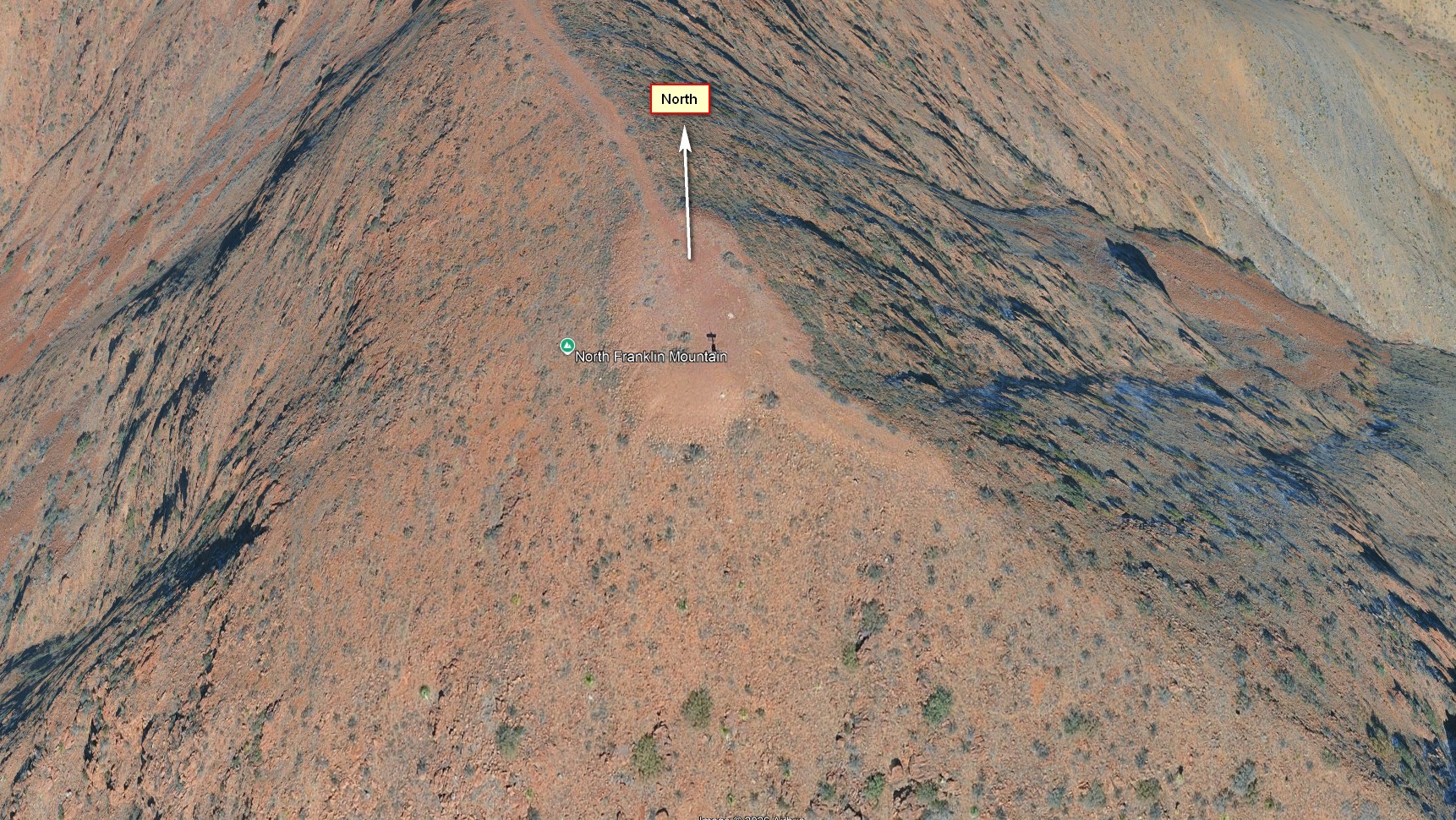
The top of North Franklin is flat, about 10m x 20m. The area west of the top is a shallow to medium slope for 50 yards with few obstacles, but there are many rocks and boulders that prevent running. The area behind east, north and south of the top is similar but is steeper and has many large bushes. Be careful to
launch as close to the front edge of launch as possible in order to have plenty of space to recover from a mishap.
The terrain out front can present many hazards, due to the convoluted topography. Pilots must use caution and fly conservatively, avoid scratching and stay high above the gullies and
canyons!
The Patriot Freeway to the east of the range is the west boundary of the Class C
airspace of El Paso International Airport. Always stay west of this
boundary and fly with an instrument that shows airspace.
General info
North Franklin was first flown back in the early 80's by HG pilots when there was a road - albeit terrible - all the way to the summit. Pilots include Robin Hastings (2 flights), Paul Michaud, Bill Kershaw, Dave Church, and Sean Riley. No HG flights have happened since the land was transferred to Texas Parks and Wildlife and the road blocked. The launch is relatively free from rotor. There is an amateur radio tower that extends about 15' above the flat (graded) summit, but it is possible to lay the wing out without interference from the tower. The airspace over the FMSP and to the west is all Class E which is good for us up to 17,999'. Pilots should always keep a lookout for other aircraft. Although launching in an easterly direction is possible in the right conditions, safe and legal LZ's may be hard to reach. Don't do it!
The main benefit of this site is its altitude and the ease with which pilots can stay up, even at the end of the day or very early in the morning.
Google Earth view of the summit of North Mount Franklin
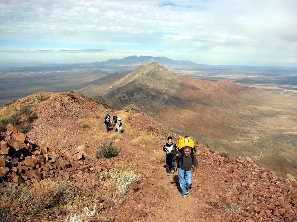
Hiking up to the summit from the north. The Organ Mountains are visible in the distance. Photo courtesy of Ken Steiner.
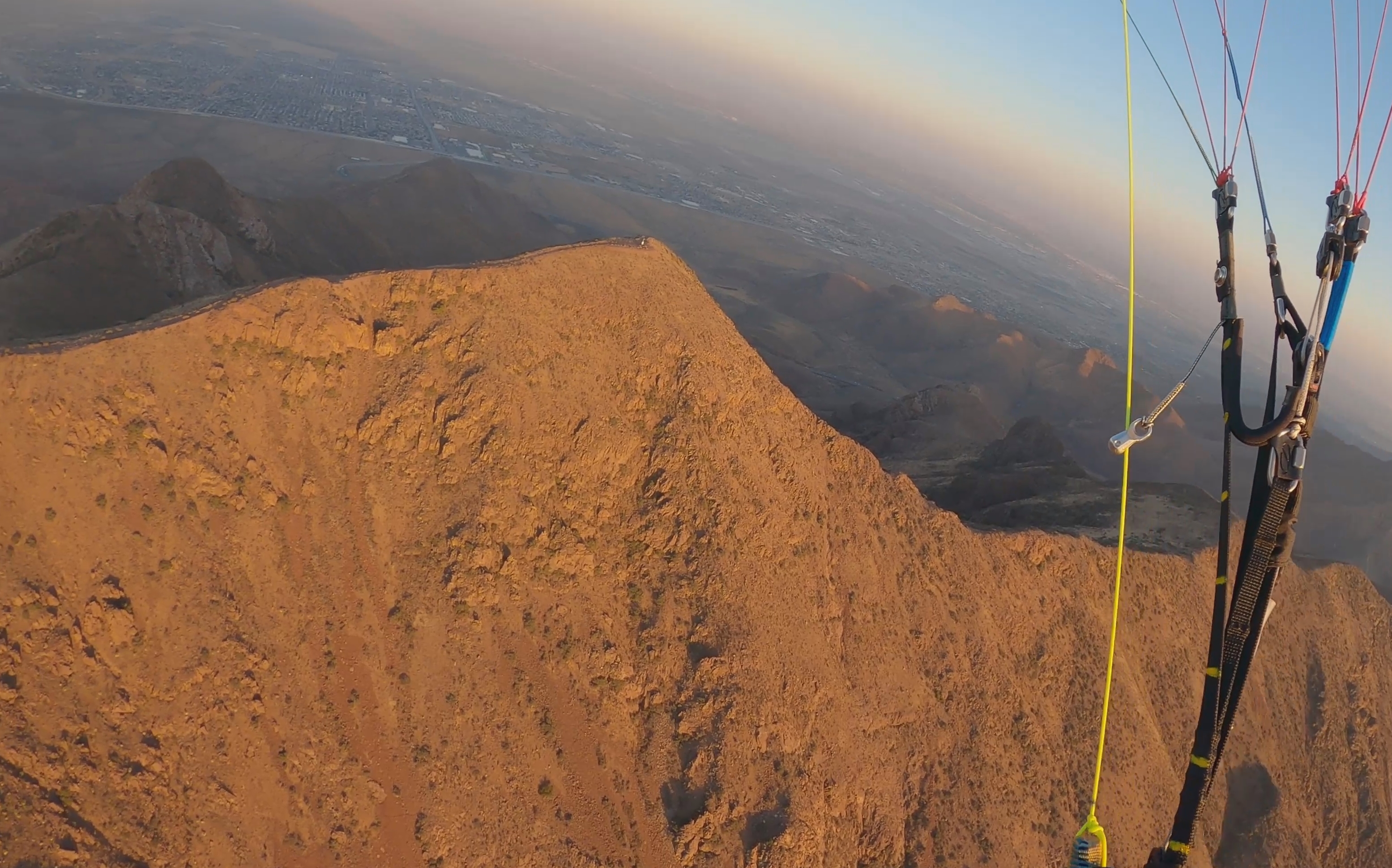
View towards the east of North Franklin from above. The road is the Patriot Freeway, the El Paso Class C airspace exists east of the Patriot Freeway.
Directions to Launch
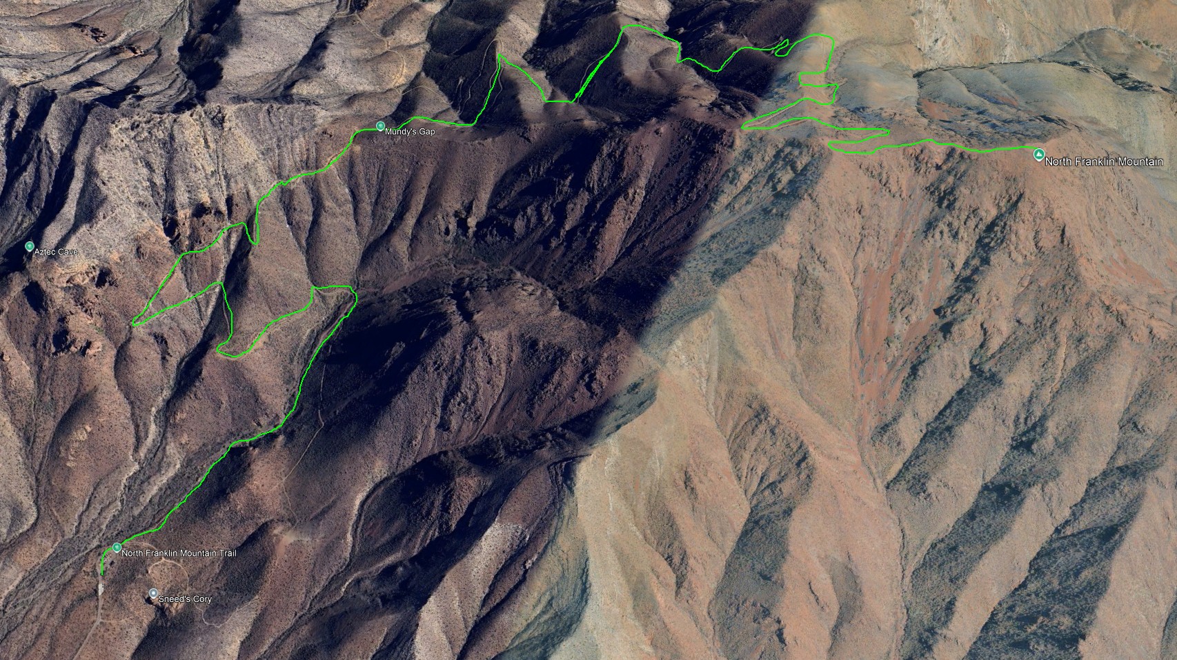
Park in the lot at the trailhead to Mundy Gap. From the Mundy Gap trailhead follow the trail all the way to the summit. This is a long and strenuous hike.
Winds and Conditions
North Franklin is launchable with winds from any direction, according to reports from hang glider pilots who flew it in the early 80's. Safest and best conditions are with a SW to NW wind. If winds are calm or light, pilots can have a 20 minute sled ride.
Winds aloft at 9K are about the same as at launch if the winds are in the same direction at both 6K' and 9K'. This means that the maximum winds aloft at 9K should be 12-16 mph for a safe launch for paragliding. It is important to launch as far forward as possible at the launch area. If there is a mishap you want time and distance to stop the glider from flying. Thankfully all sides of the peak have modest slopes without sheer faces.
Launch is possible even when synoptic winds aloft are calm (6K'-9K') because of anabatic flow up the peak which creates a good updraft at launch (about 7 mph measured when winds aloft were calm). Winds at Mundy Gap (the high mountain pass one mile north of the summit) proved to be about the same as at the peak – both are very exposed and Mundy will experience some increase in wind velocity because of a venturi through the gap.
After launching in SW to NW winds pilots can look for modest ridge lift and then head west when reaching the main finger that comes up from the Triangle (see the site info for Agave Hill). There is almost always lift of some sort in this area, including weak thermals. Pilots should use caution in the huge bowl just west of the peak as sink can be present there. Launching east requires caution and skill because there are no LZs to the east, and also Class C airspace. If launching east, the idea is to get high enough to turn safely west and land near the visitor's center.
LZ
Top landing North Franklin is possible, but to our knowledge it has only been done once, by Lee Boone and Mitch Graham in December 2020. They landed their PPG and were able to re-launch.
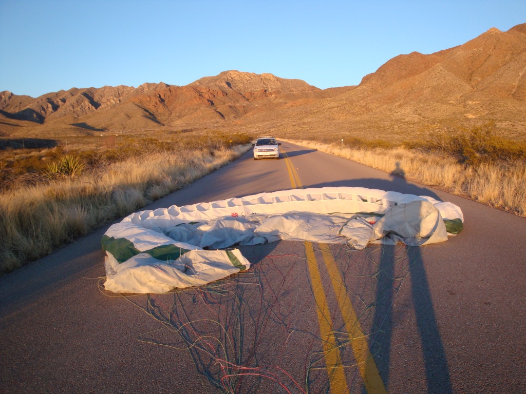
The Park authorities have graciously permitted us to land anywhere in the Park, including on roads! There is usually very little traffic on the access road which is our general LZ for all sites within the Park. When traffic is encountered, ALWAYS give them the right of way! However, drivers will typically wait until we clear the area –
as here.
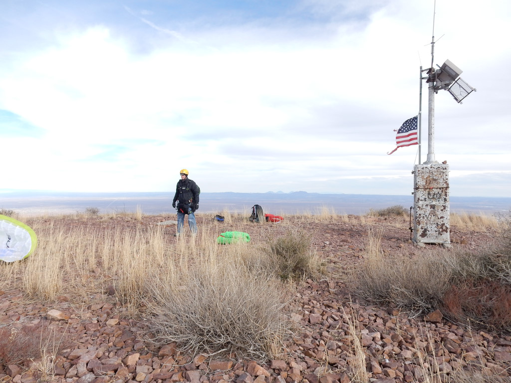
The only obstacle at the summit is a short amateur radio station. Jason Tilley watches Steve Crye setup for launch. Photo Hadley Robinson.
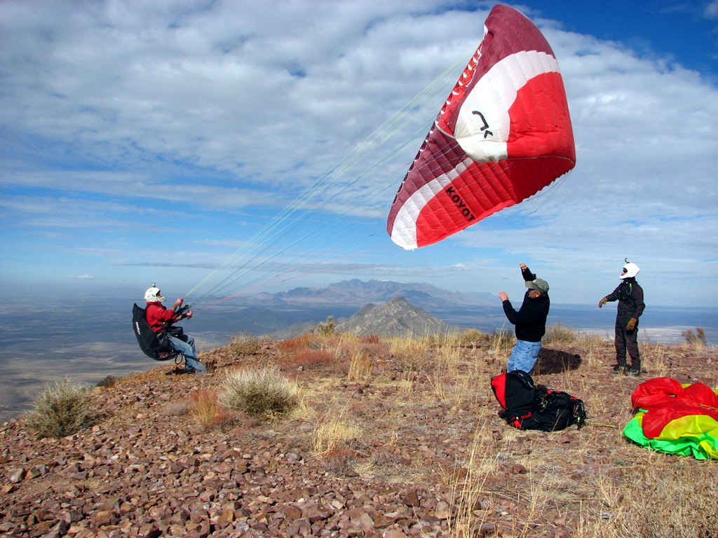
The late Lee Boone, pilot extraordinaire, inflating his glider. Had Robinson is wearing the white helmet. View is north. Photo courtesy of Ken Steiner. ~ 2012
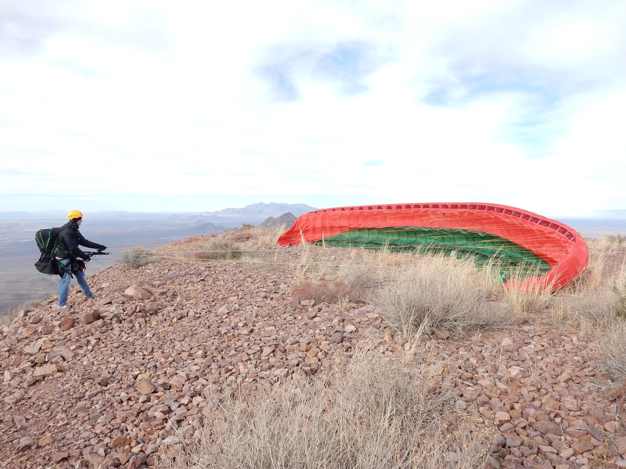
Jason Tilley "building a wall" in order to check his lines, February 2016.
Here is a short video of Jason launching in strong conditions in February 2016 .