La Luz
Revised 20260116
La Luz, NM 32.971658° -105.917189° 5,856' MSL 1,100' AGL
When flown during thermic times/dates, TURB recommended
There are mutiple launches.
NW Launch:
Minimum Required Rating H2/P3
PG:
Wind Strength (MPH)
Minimum 10, Ideal 12, Max 15, Gust 5
Launch Faces 312°
Synoptic Wind Direction (Degrees)
Ideal: Left 290 Right 340
OK: Left 290 Right 350
Minimum Required Glide Ratio: 6.2
HG:
Wind Strength (MPH)
Minimum 7, Ideal 12, Max 20, Gust 5
Launch Faces 312°
Synoptic Wind Direction (Degrees)
Ideal: Left 290 Right 340
OK: Left 290 Right 350
Minimum Required Glide Ratio: 6.2
West Launch
Minimum Required Rating H2/P3
PG:
Wind Strength (MPH)
Minimum 8, Ideal 12, Max 15, Gust 5
Launch Faces 272°
Synoptic Wind Direction (Degrees)
Ideal: Left 230 Right 290
OK: Left 200 Right 300
Minimum Required Glide Ratio: 6.2
HG:
Wind Strength (MPH)
Minimum 6, Ideal 12, Max 15, Gust 5
Launch Faces 272°
Synoptic Wind Direction (Degrees)
Ideal: Left 260 Right 280
OK: Left 250 Right 290
Minimum Required Glide Ratio: 6.2
SW Launch
Minimum Required Rating H2/P3
PG:
Wind Strength (MPH)
Minimum 7, Ideal 10, Max 15, Gust 5
Launch Faces 240°
Synoptic Wind Direction (Degrees)
Ideal: Left 210 Right 260
OK: Left 200 Right 270
Minimum Required Glide Ratio: 6.2
HG:
Wind Strength (MPH)
Minimum 5, Ideal 13, Max 15, Gust 5
Launch Faces 240°
Synoptic Wind Direction (Degrees)
Ideal: Left 210 Right 260
OK: Left 200 Right 370
Minimum Required Glide Ratio: 6.2
Site Protocols / Rules
The launch is on Lincoln National Forest Land and the LNF does not have any rules or protocols related to non-powered Ultralight Vehicles operating under FAR part 103.
La Luz launch and access roads are either USFS or BLM with no restrictions. The owner of the LZ is listed as Lisa L Quintis of Las Cruces, but it is used by ATV's and motorcycles and we have never been challenged by the landowner.
Key Site Safety Information:
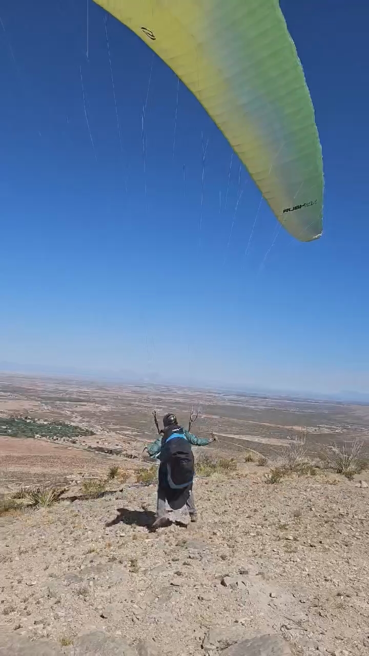
The NW launch is ideal for HG but not so much for for PG . PG pilots should
be aware that the launch areas were pioneered by HG pilots and are not
necessarily ideal for PG. PG pilots need stong ground handling and launch skills; there are snags the NW launch has a dead zone where the wing is laid out.
In thermic conditions the LZ is a dangerous place for PG, and serious injuries have occurred. That having been said, La Luz has yielded many great flights for HG and PG alike over the years. Choose conditions carefully.
There are residential power lines running across the north and east edges of the LZ.
General Info
La Luz was originally primarily an HG site that in recent years has seen some amazing PG flights. It is possible to launch from La Luz and land at Hang Glider Park!
The various launches at La Luz are launchable with southwesterly to northerly winds. There are (3) launch areas that favor a particular wind direction. Choose the one that has the air coming in the straightest.

View from the NW launch. This launch is flat, wind-shadowed by the cliff face - inflating the wing is a challenge.

Hangies setting up for the NW launch, Truck is Robin Hastings trusty Tacoma that he wore out driving pilots to Dry and La Luz for 15 years.
Norm Bloom launching from the West launch. Click on image for video.
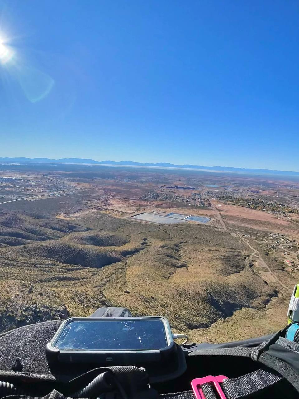
View west towards the primary LZ
Directions to Launch
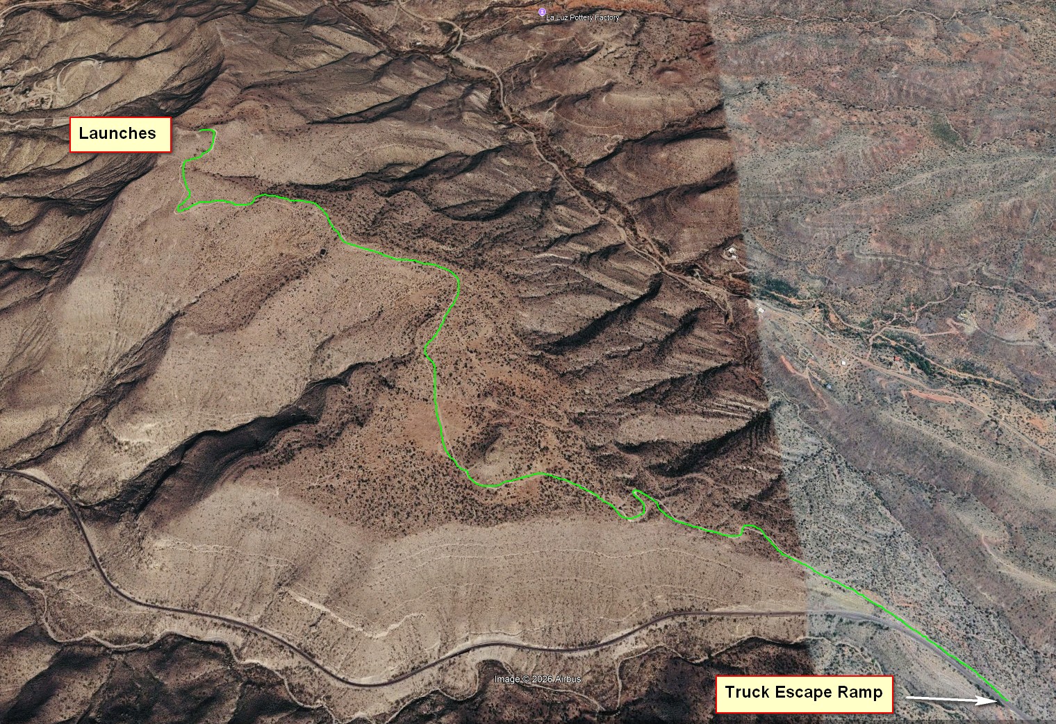
Access is via Mill Ridge road, a very rough 4x4 road off of Highway 82. It connects with Highway 82 at the runaway truck ramp here: 32.95289176579258, -105.8910399761036 . Follow the road to the top of the ridge.
LZ
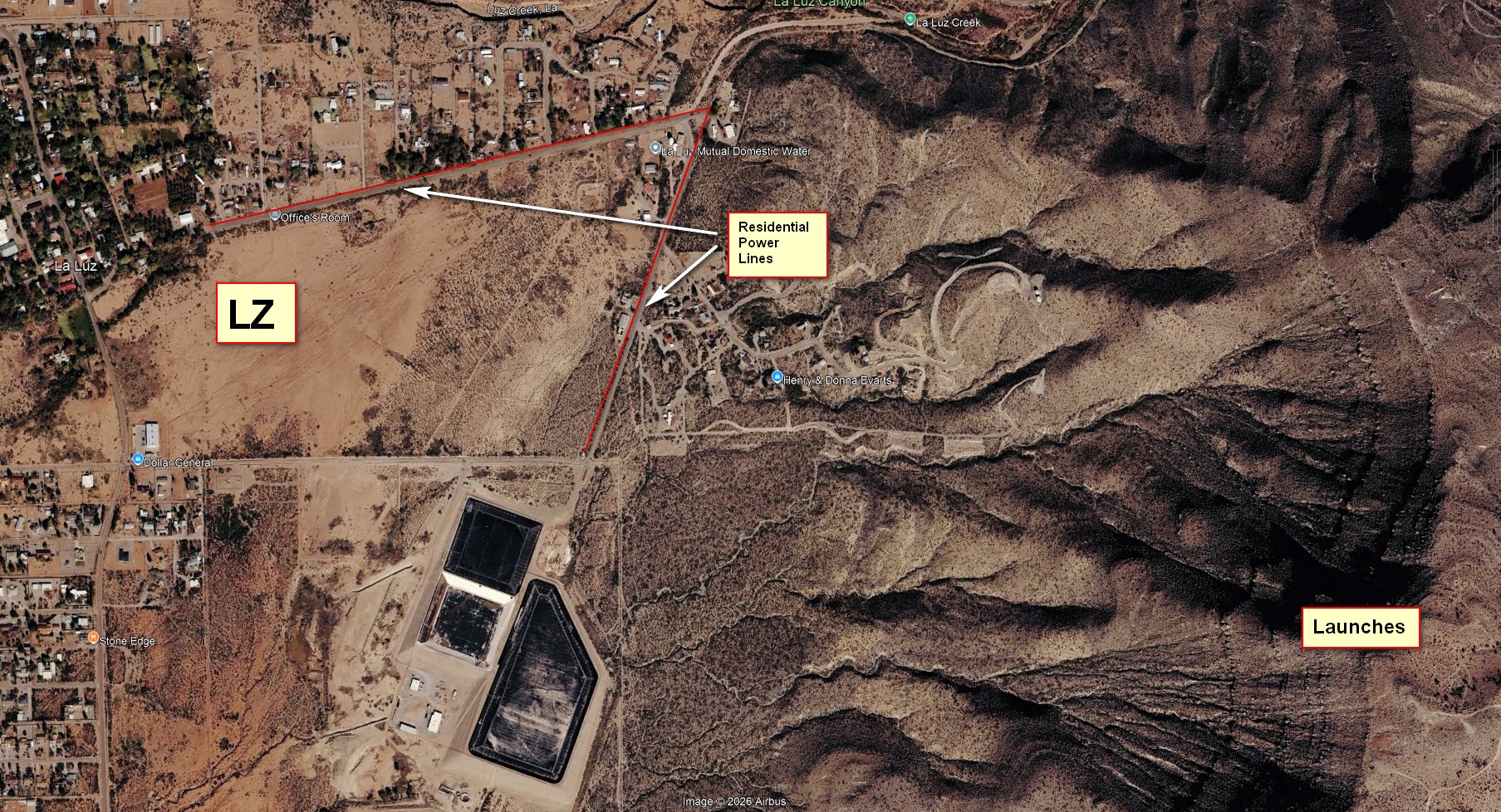
The primary LZ is an enormous field 1.3 miles WNW of launch
Directions to the LZ: From Hwy 70/54 go on Hwy 82 east towards Cloudcroft.
Take a left at the blinking lights that mark Florida Avenue, and go north
about a mile or so to Valley View Drive, about 100 yards before you reach
the trees of the village. Go right about ¼ mile to where you can look over
the barbed wire into the huge open field. Don’t drive into the field, though
– it’s private property.
Winds and Conditions
La Luz is typically flown when winds are NW to N, because if winds are from the S to W, Dry Canyon will work and it is so much better.

When winds are northwest or west, the area of max
lift was not the north spine but was the south spine. The sink over
the canyon between the two spines was severe – as we would expect.
Elevation profiles of the PG track below clearly showed the lift patterns of
the spines – the south was much more robust.