Anapra Mesa
Revised 20260116
31.786567° -106.582500° 4,081' MSL 200' AGL
Rated H/P2
, RS recommended
Hangies: ideal direction 80° - 100°, min 9, ideal 15, Max 20, Gusts 5 (all mph)
Baggies: ideal direction 80° - 100°, min 9, ideal 12, Max 15, Gusts 5 (all mph)
LZ - top land, or land right at the base of the hill.
Site Protocols / Rules
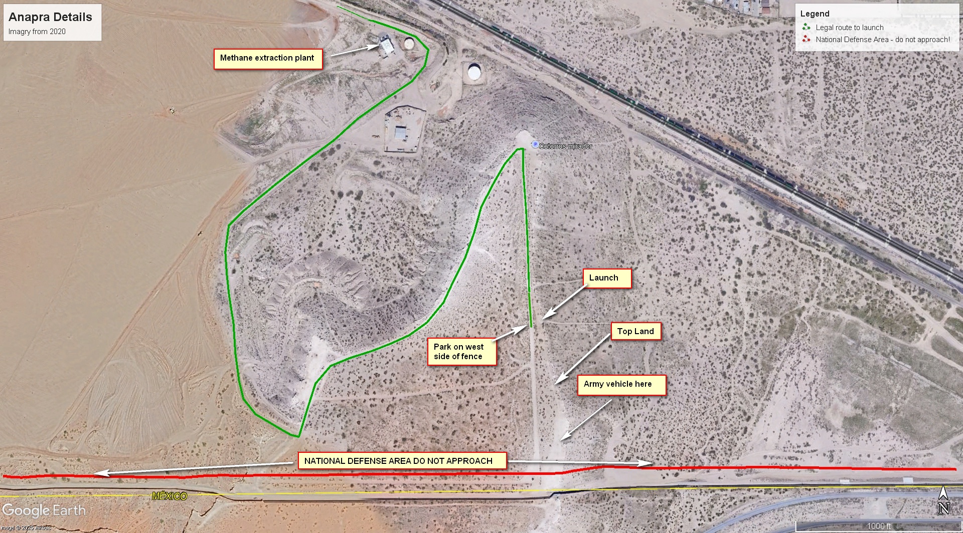
CAUTION - new access restrictions! The establishment of a National Defense Area along the border wall affects how we access the Anapra launch. DO NOT APPROACH FROM THE SOUTH BY THE BORDER WALL. PAY ATTENTION TO THE SIGNS. We are allowed to launch and top land on the east side of the barbed wire fence, but all approach must be from the north. It is best to park on the west side of the barbed wire fence opposite the launch and crawl under the bottom wire.
Stay a minimum of 100' north of the border wall, both on the ground and in the air. If you cross into the National Defense Area along the border wall you could be arrested. This is no joke. It is OK to cautiously approach the Stryker vehicle and troops from the north and talk to them; they are usually interested in paragliding. Do not land near or south of the Stryker.
We advise calling the Border Patrol AMOC (915-775-7050) and letting them know you will be flying. They can then advise all local LE helicopter pilots to look out for you. You DO NOT want to get caught in copter downdraft!
You have to go through
guarded private property to reach launch. Visitors must tell the guards at the landfill that they are there for flying the mesa. We have the kind permission of the Camino Real Landfill
superintendent, Dr. Juan Carlos Tomas, to trespass.
If you want to bring the guards a 6-pack of cold beer/soft-drinks, it would
not hurt....
Key Site Safety Information:
There is significant rotor all along the Mesa
30 feet back from the rim. If you are not an experienced kiter, be sure to have help
when launching as you do NOT want to be dragged into the barbed-wire fence just behind launch. The New Mexico Environmental Protection Agency requires that landfills have their boundaries
fenced and the fence here, while not really doing anything, must remain per New Mexico State law.
Warning: the ridge itself is a
calcified escarpment that is sharp and will cut glider lines if they are
dragged across it.
General Info
Located adjacent to the US-Mexico border, it is perfect for new pilots as it has few hazards. The LZ at the base of the hill is huge and flat. Top landing is possible but requires caution and skill. The site is almost all soft sand and is forgiving of hard landings and other mistakes.
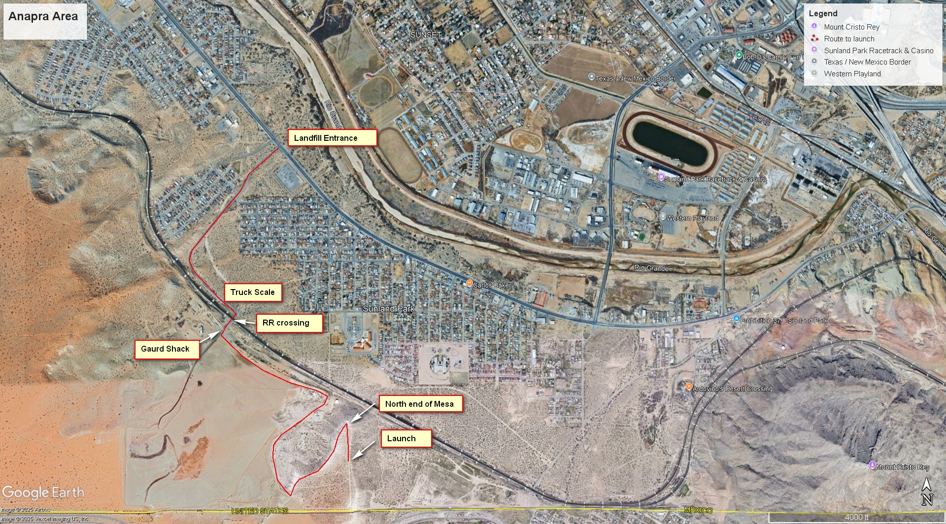
Directions to Launch
Go to the Camino Real Landfill (31.806763° -106.588187°) (Map Pin) entrance off of Sunland Park road, then refer to images below. Map pin for the launch, but DO NOT just let Google guide you!
LZ
Lading below the hill is easy and safest option.
Top landing requires caution and skill due to potential rotor and the barbed wire fence, but the south end of the ridge is plenty wide enough. If you miss, go, around and try again. The approach is best heading north to south, you want to be about 50' over the launch spot as you start the approach. Stay slightly west of the dirt track that runs between the barbed wire and the edge of the mesa. DO NOT go too far back, you might end up in rotor. If you time and position your approach correctly, your wing will still be in the smooth flow when you turn left into the wind and touch down. DO NOT land near the army vehicle or the border wall!
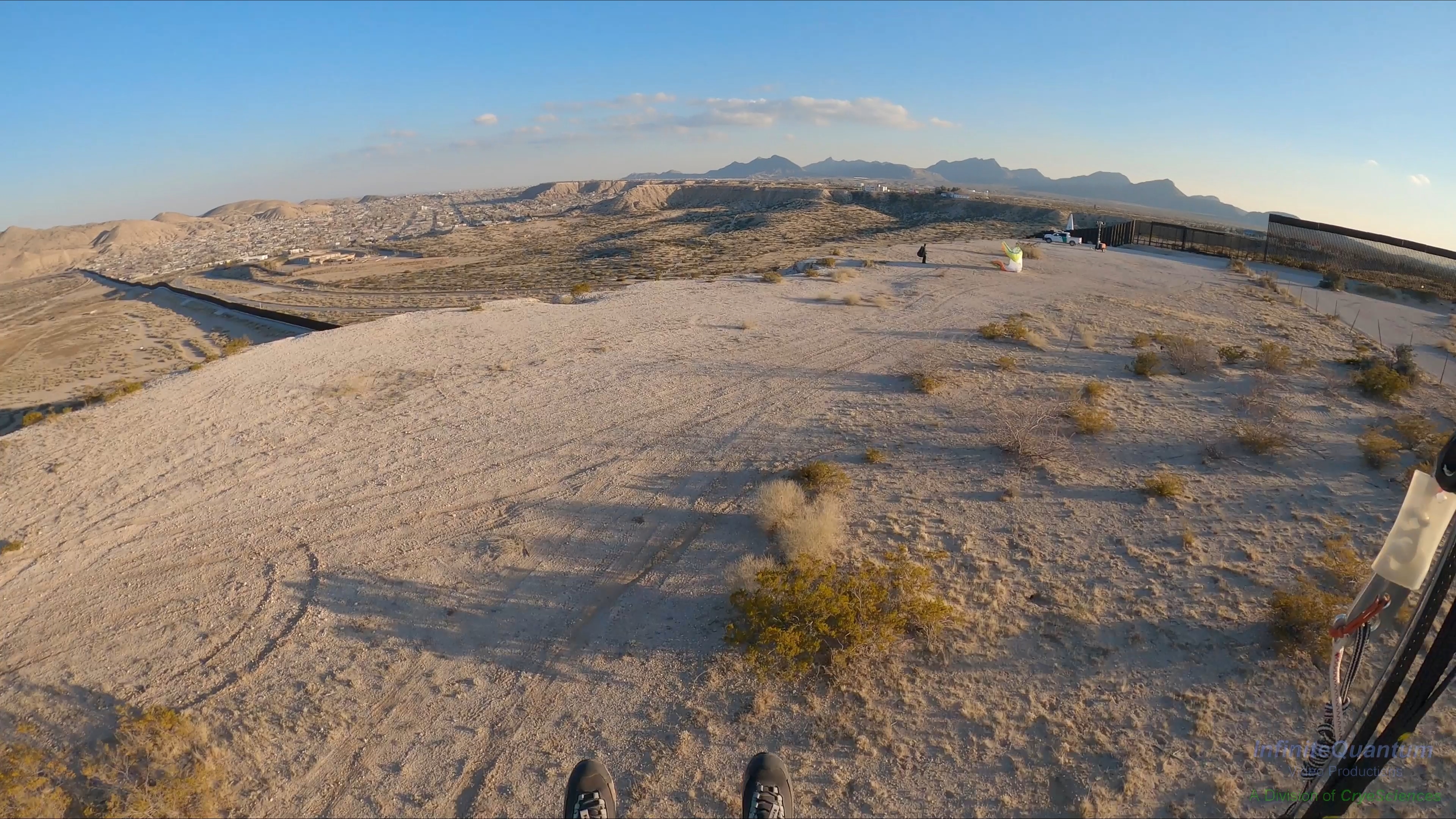
Top landing just before touchdown.
Here is helmet cam footage of the top landing:
Helmet Cam view of top landing
The site has a benign LZ 500' in front if you are nervous about top landing. BUT ... slogging back up the 250' sand hill will feel like a 700' climb.
Launching
Center launch – view is SE. Winds were about
7-8, just barely strong enough to stay up out in front of the Mesa with a lightly loaded wing.
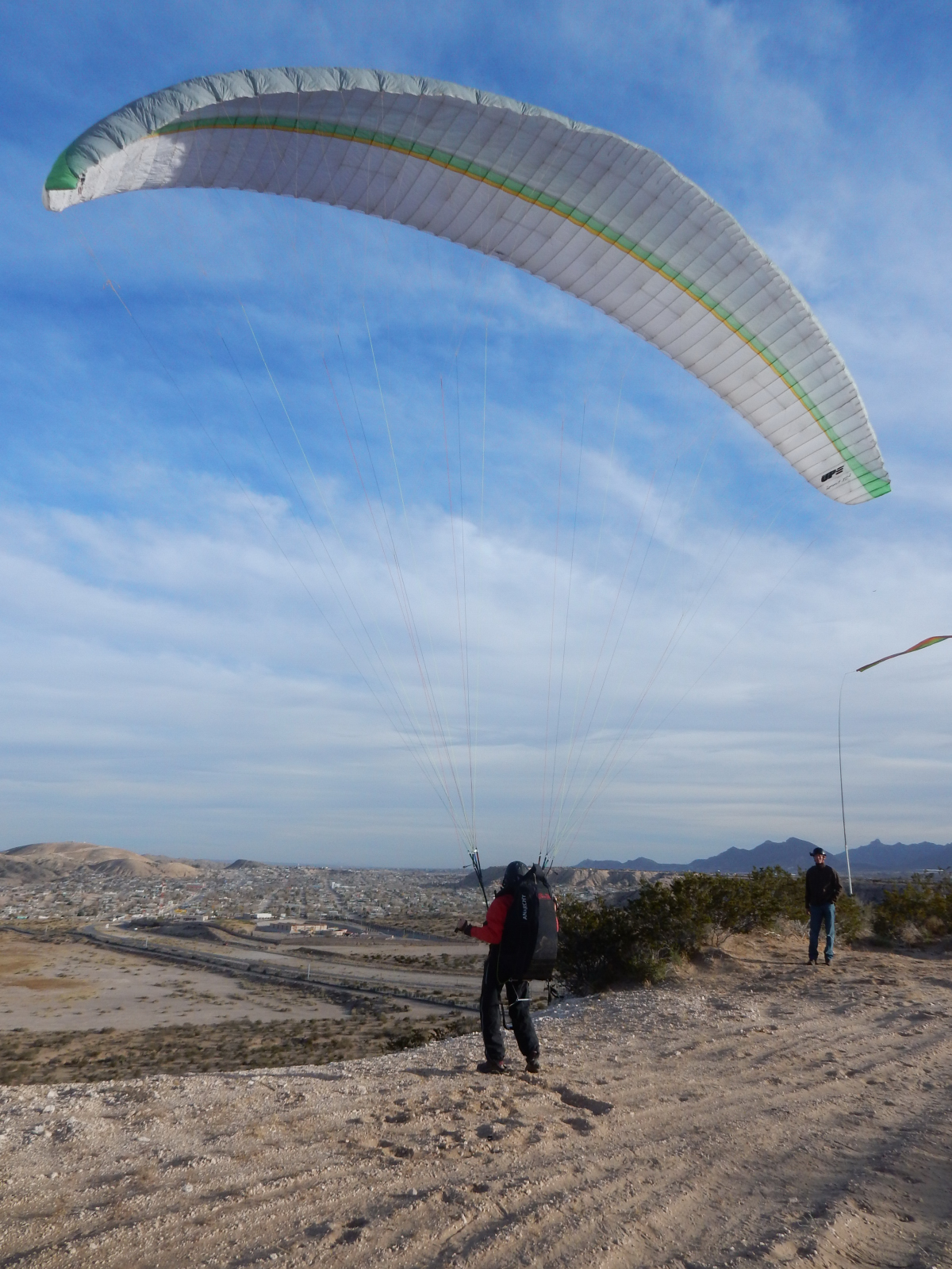
Above, the late Lee Boone kites at the middle launch with Matt Hayes observing. We miss you Lee!
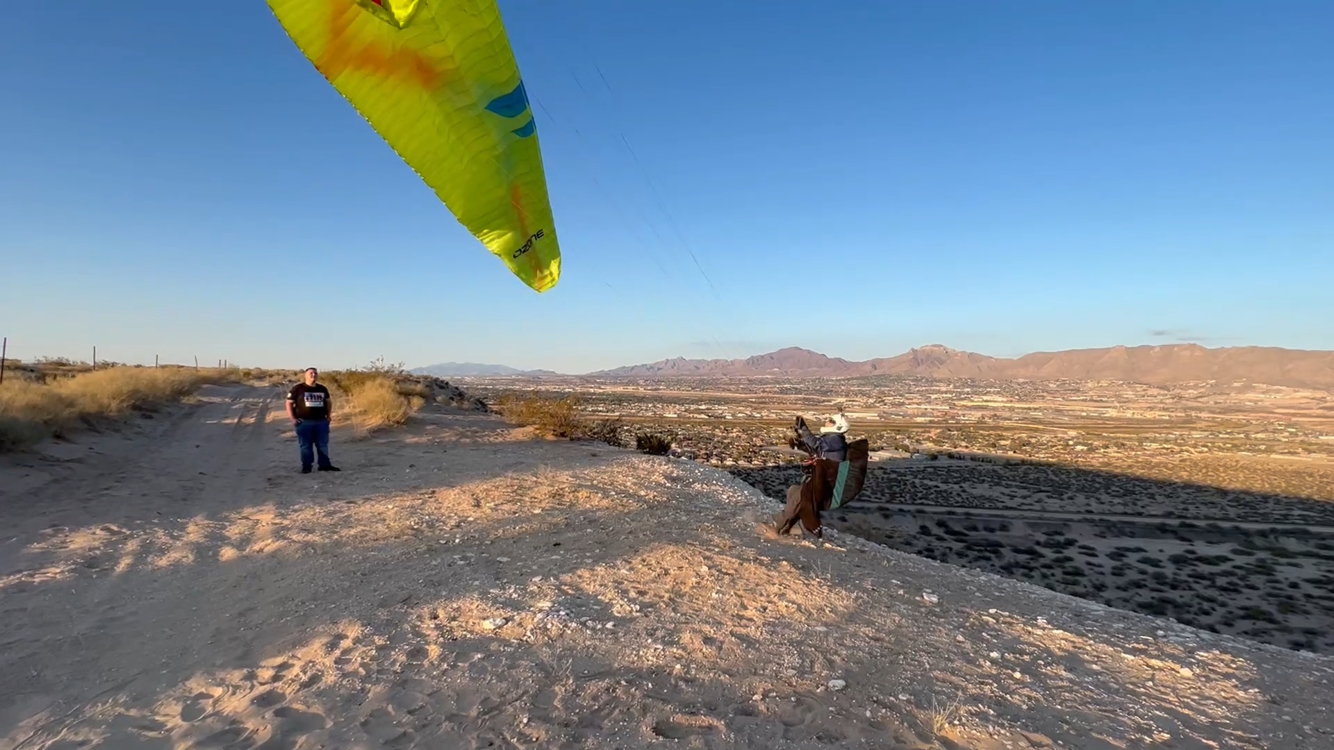
Steve Crye inflating in ideal conditions, about 12 mph. Note the barbed wire behind launch - you need to use A's and rear risers and correctly control the wing. That having been said, it is rare for a wing to end up in the barbed wire.
Here is a video of a typical launch for soaring, almost always turn left (north) after launch:
Typical Anapra launch
Winds and Conditions
This is a ridge soaring site, typically flown close to sunset or in the winter when thermals are not present. It is only soarable with ENE to SSE winds. E or ESE is always the best. Because of the Pass, winds at launch will usually be slightly cross (~20°) to the right. If they are anything else pilots can expect some turbulence. Speed needs to be from 9-15 mph for PG unless you are in the mood for a super short sled ride. How to tell without a wind gauge? If the tops of the Creosote bushes at the rim edge are swaying less than 3-4", conditions are too weak to stay up. When winds are strong enough for mini-wings there is considerable blowing dust and turbulence... not recommended.
Typically, the weather models that are most accurate are usually NAM and HRRR, but it is good when GFS and ECMWF also agree. We all know that models lie, but it is an easy drive to launch so why not good look? It is a good idea to look at various stations up and downwind from the site, such as the Juarez Airport and the Santa Teresa Border Station. The site easily blows out and winds tend to go south late in the day. If the stations show a solid E, ESE, or SE direction, you should be good to go.
This
PowerPoint presentation by Tom Bird of the National Weather Service gives the a number of forecasts and observations that will help pilots to accurately
determine the best time to soar Anapra. It is somewhat technical but worth the effort to learn how to read weather models and observations which dramatically improves pilot safety.
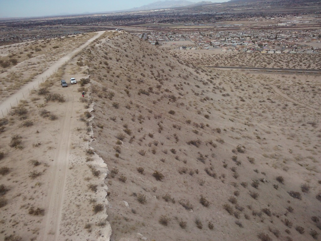
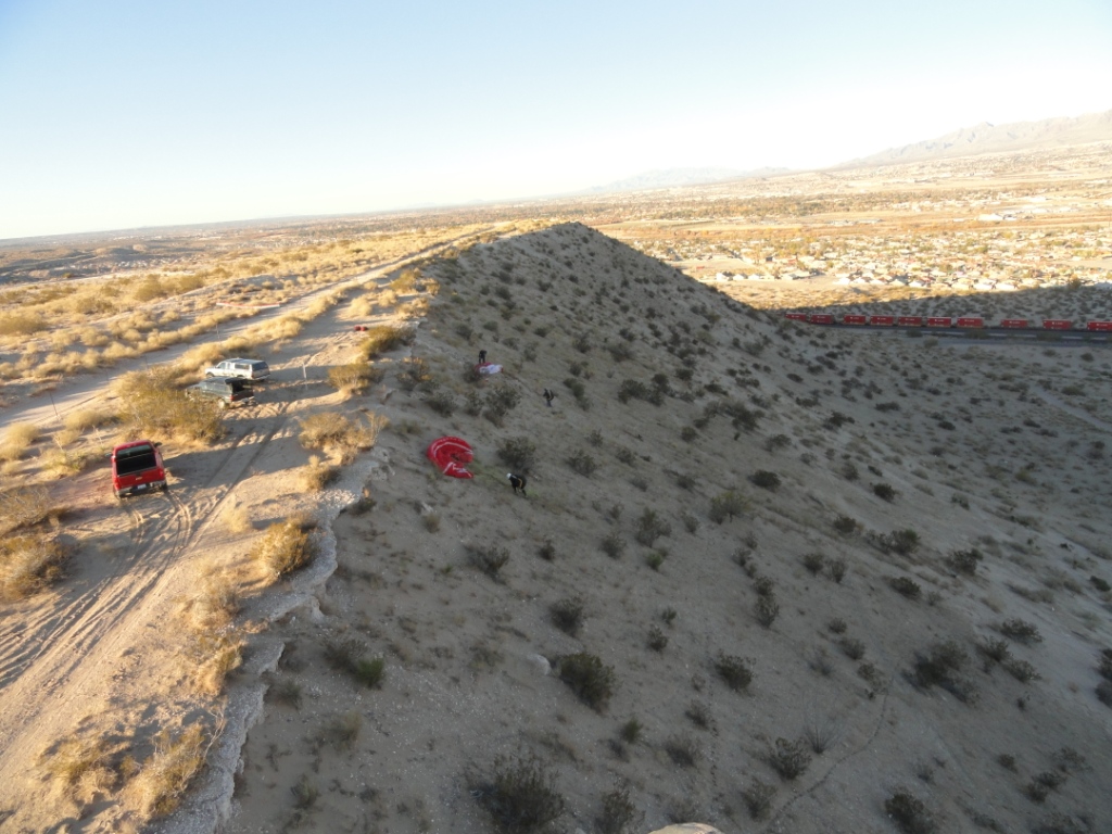
The south half of Anapra Mesa. Launch is just behind where
this photo was taken. Skilled pilots can "park" above the mesa.
View here is south.
The best launch is close to the middle of the mesa where a deep notch comes through. The notch causes the air to flow more smoothly over this part of the rim so there is less turbulence and rotor at launch. It is possible to kite here.
View looking north.
The barb wire fence behind the launch area is visible. NOTE: it is now almost impossible to park on the east side of the barbed wire fence. Access from the south is illegal, and the deep sand to the north is almost impassible. Instead, park on the west side of the fence and crawl under it.
NOTE: it is now almost impossible to park on the east side of the barbed wire fence. Access from the south is illegal, and the deep sand to the north is almost impassible. Instead, park on the west side of the fence and crawl under it.
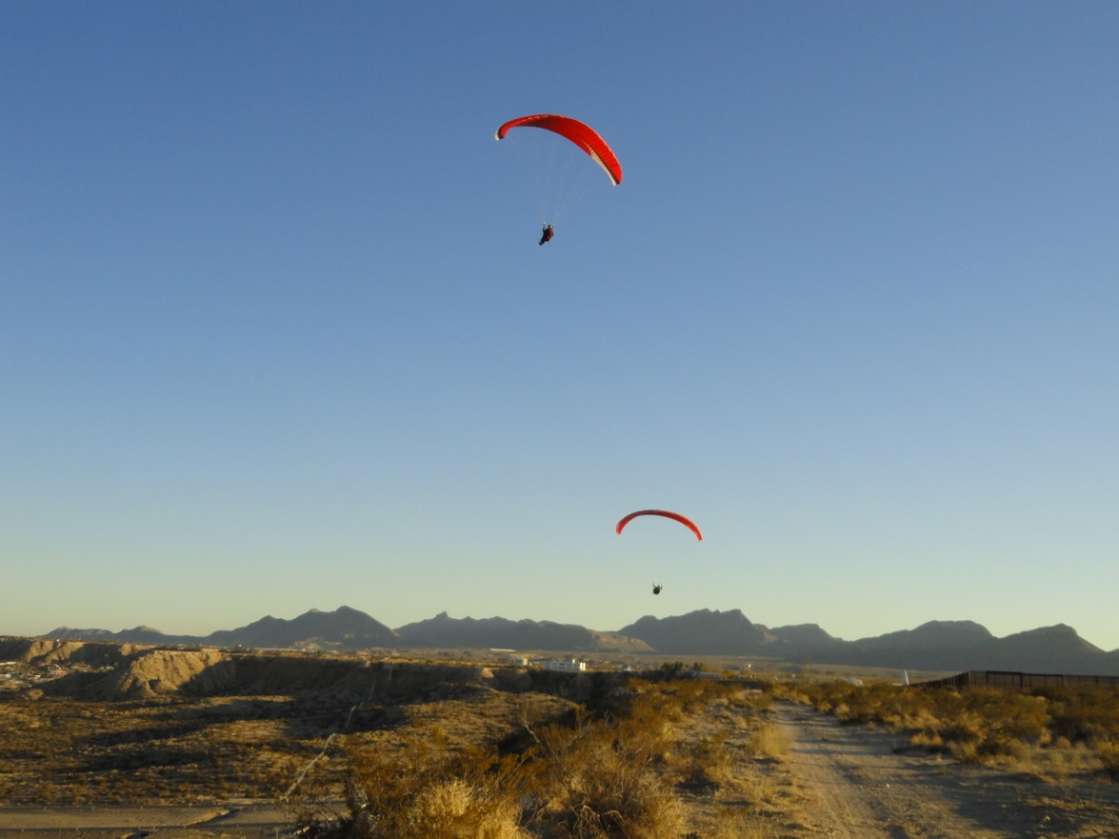
In the photo above, pilots can be seen preparing to launch. The far pilot is
setting up just below the center launch area (a red bag on top is just barely visible).
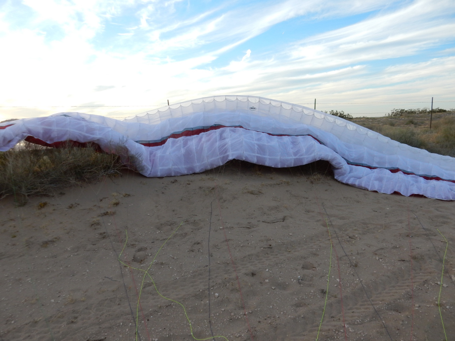
Spreading out below the rim is a safe option because if you have a
mishap inflating, you will NOT be blown into the barb wire fence that goes
along the east edge of the dirt road. These pilots had never flown the
site which is why the site guide asked them to launch below the rim.
The downside of launching below the rim is that there is more plant debris
that can get caught in your glider lines. Note: With a bit of practice with A's and C's inflations, it is not a big deal to avoid the barbed wire, particularly if you have some friends to help if the wing gets away from you.
If you want to work on your side-hill landing skills, this is
the place to do it – it's all soft sand and is very forgiving of major
errors. If your wing goes into a bush, be prepared to spend some time
getting it out.
When launching turn north
(though downwind) and fly to near the north end of the mesa. The best lift
is between the middle and the north end of the mesa. If you launch and can't
keep level with the mesa, you are probably going to sink out. Turn south and
side-hill land anywhere on the hill in the soft sand.
The Second Wave
There is a small mountain about 2 miles east (upwind) of Anapra Mesa. Winds striking Cristo Rey generate lee-side waves that sometimes reach Anapra
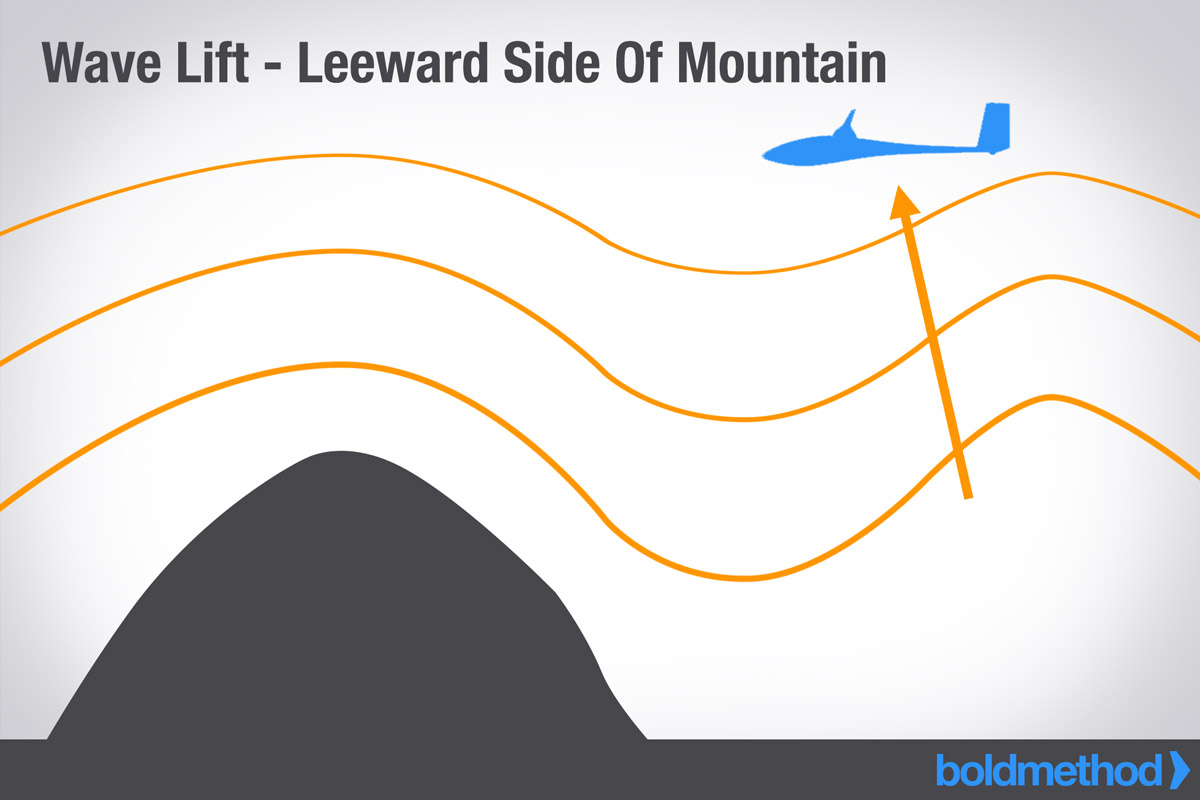
Skilled (or lucky) pilots can catch the "Second Wave" and reach hundreds of feet over
launch. There are several ways to get to the 2nd wave. One is about half way between launch and the north end of
the mesa. The challenge: Positioning yourself in just the right
spot in the ridge lift above the Mesa where the standing wave mixes with the
ridge lift. You will feel a slight tug and you have to turn in it at just
the right moment. Another way is to get as high as possible, as far out front as possible, to the northish side of the hill, until you feel the wave lift. Only a handful of pilots have done it. The current record for the 2nd wave, 1400' over launch, was set on 2/18/2023 by Steve Crye flying an Ozone SwiftSix.
Here is a link to a helmet cam .MP4 from 1250' over launch:
Helmet Cam 1250' over launch
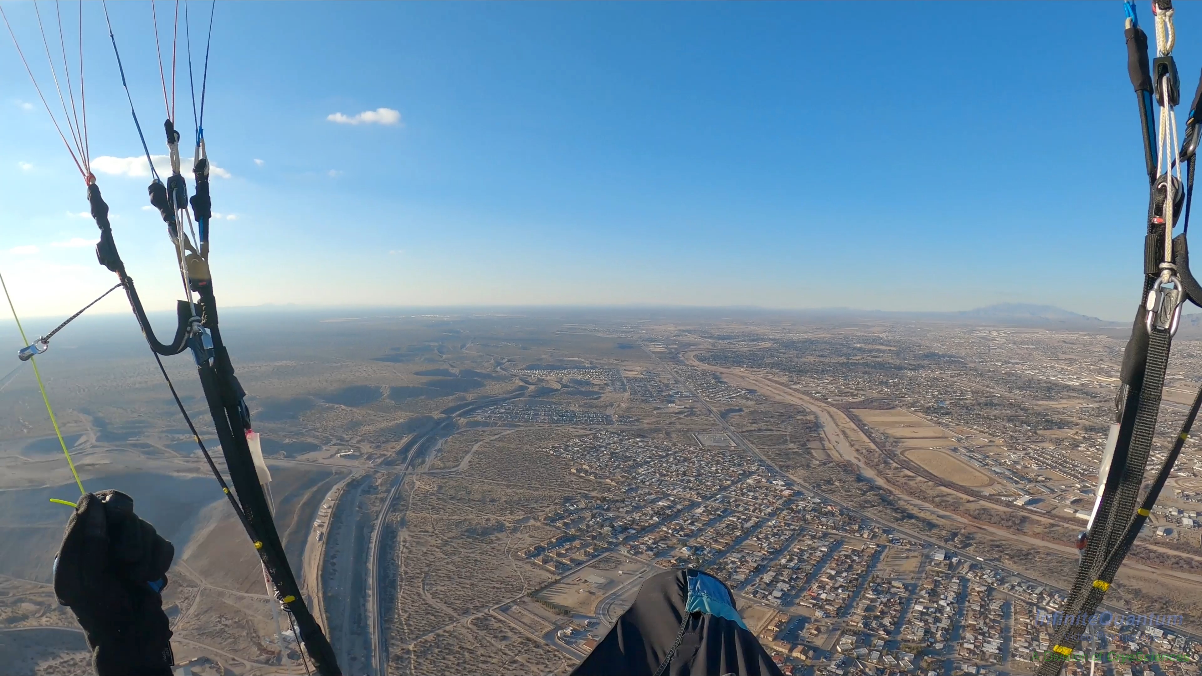
Steve Crye ~ 1300' over launch in 2nd wave Feb. 18, 2023. There were no thermals during this flight - the pilot rode the wave lift from Christo Rey.
Arizona visiting pilot, Gingher Leyendecker, is parked at the bottom of the
"Second Wave". She is the first non-local to get up in it.
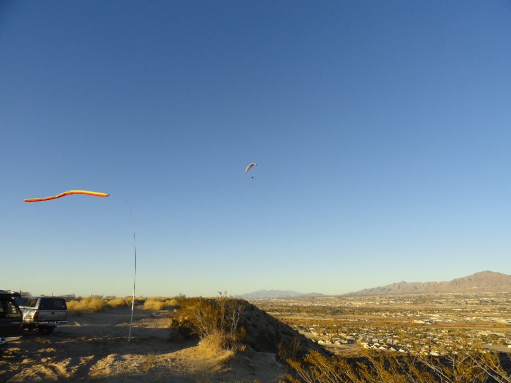
Remember this is a mere 250' hill – how do pilots get up there? See
if you can do it.
January 26, 2023 - Steve Crye rides the 2nd Wave 1529' over launch.
https://youtu.be/MSO5XvFqiIw
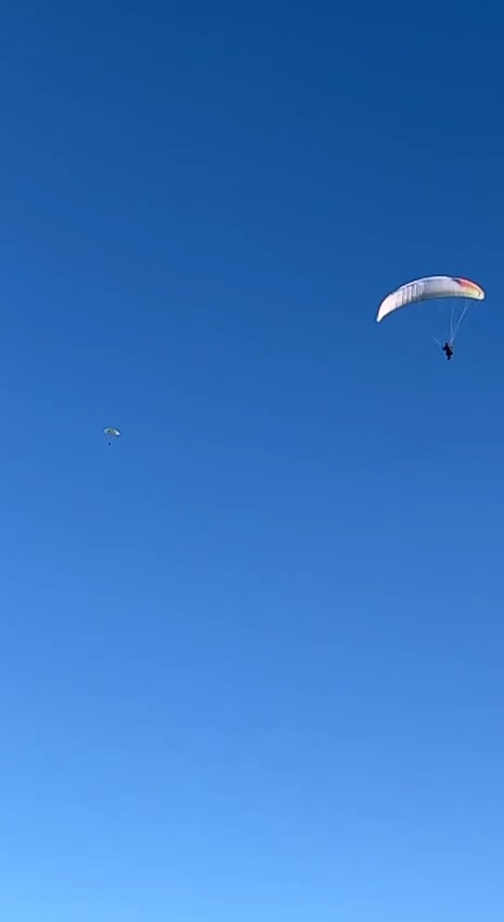
Look for the green speck in the middle left - that's what a PG looks like 1300' over Anapra in the 2nd wave.
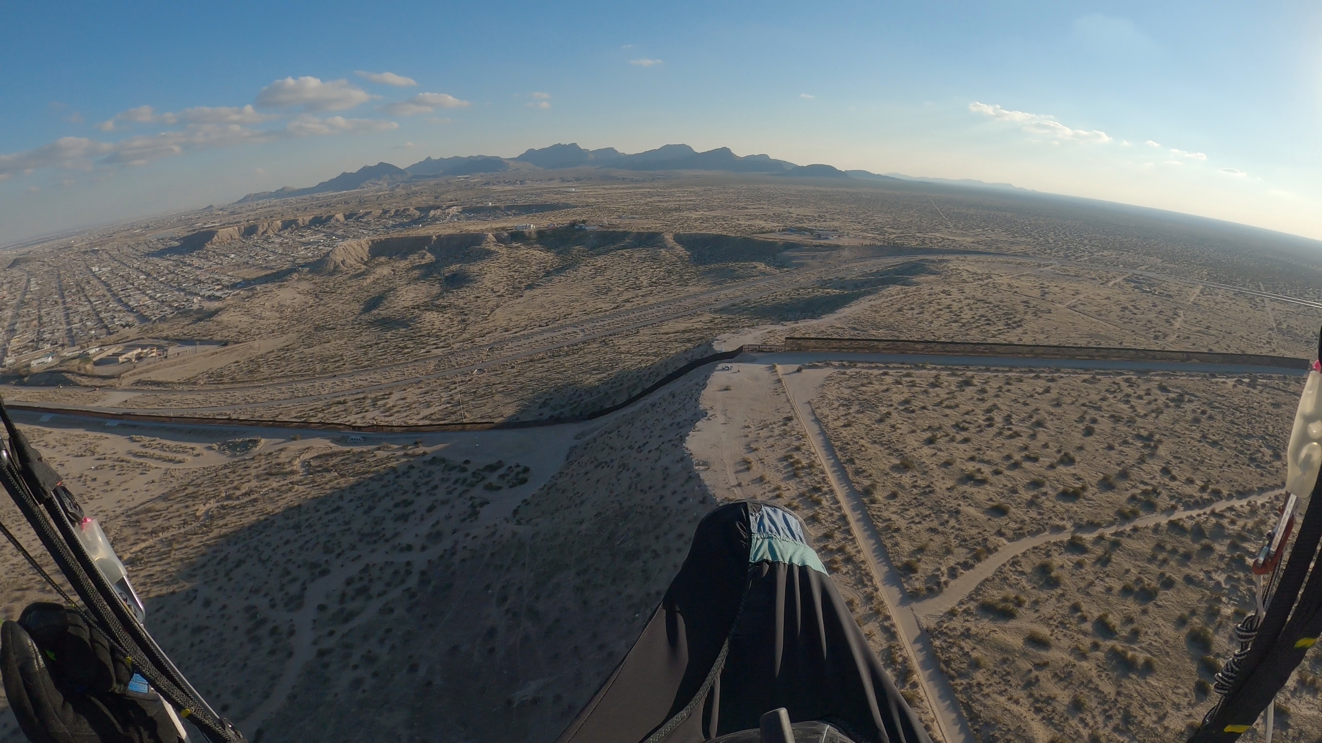
The view of the USA-Mexico border and wall.