Guadalupe Ridge
Revised 20260116
Launch 6,000' MSL, H2/P2 with prior mountain experience
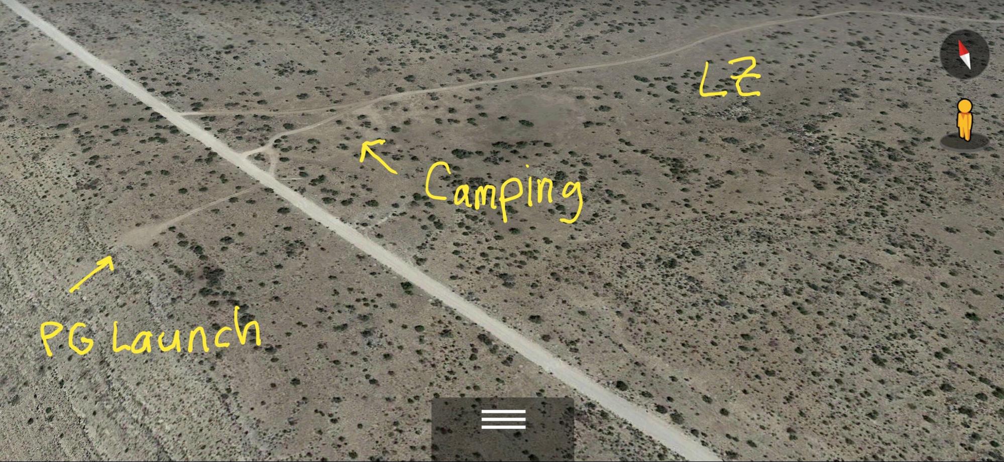
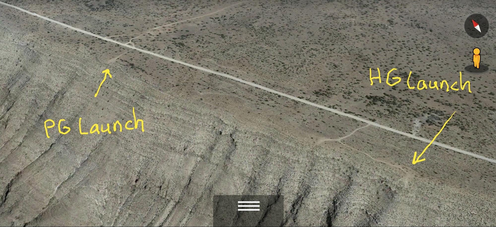
PG launch 32.2605710º -104.8963580º
HG launch 32.2537955º -104.8933776º
LZ - top landing - 32.2618089º -104.8919299º Glide ratio depends on where you land and how high you are when you start your approach.
LZ - in the valley of shame - glide ratio between 5 and 8 depending on where you set down - flat, treeless, and unlimited options.
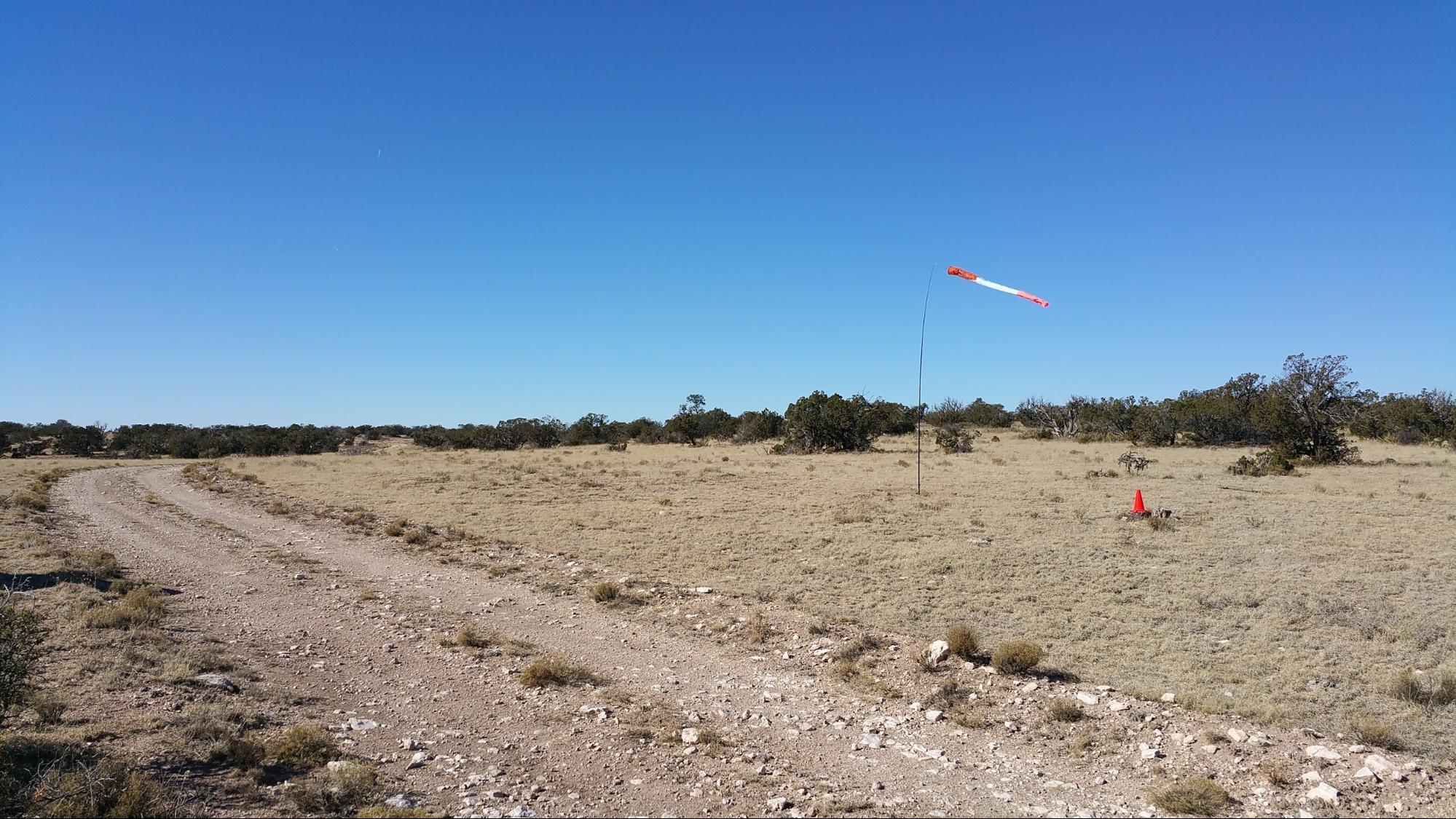
Camping 32.2614743º
-104.8945816º
When flown during thermic times/dates, TURB recommended
RS recommended
HG Launch:
Hangies: Ideal direction 240° - 260°, OK 235° - 270°, wind Min 7, Ideal 12, Max 20 Gusts 5 mph
Baggies NOT RECOMMENDED at HG Launch!
PG Launch:
Baggies only, Ideal direction 240° - 260° , OK 235° - 270°, wind Min 7, Ideal 10, Max 15 Gusts 5 mph
LZ - Top land right at launch or behind the campground. Glide ratio depends on where you land and how high you are when you start your approach.
Site Protocols / Rules
The launch and top LZ is on Lincoln National Forest Land and the LNF does not have any rules or protocols related to non-powered Ultralight Vehicles operating under FAR part 103. If you land below you will land either on BLM or rancher property. Try to land near the road, be refpectful of livestock and property.
The entire ridge is in the TALON MOA. Although there are no prohibitions against flying in the MOA, check with the CONUS FSS (800-992-7433) to see if there are any scheduled training
flights, and to let them know you will be operating there. PLEASE CALL because the jets like to fly low and fast along the ridge.
Key Site Safety Information:
PG PILOTS - DO NOT TOP LAND BETWEEN 100 FEET AND 500 FEET BEHIND (EAST OF) THE TOP OF THE
RIDGE! ROTOR!
When the winds at launch are more than 10 mph, the rotor behind
launch extends from 100' behind the rim back to at LEAST 300' Don't mess with rotor! In 2022 an HG pilot suffered a broken arm to the north of the PG launch during a hard unplanned landing just east of the top of the ridge. Pilots are urged to use caution when flying anywhere near the east edge of the ridge - this is an area plauged by rotor. It is better to turn to the west even if it means sinking out to the valley floor. Wouldn't you prefer a long hike up or a long retrieve to an injury?
Thermals can mix with ridge lift mid-day and make for unpleasant conditions in the spring and summer.
General info
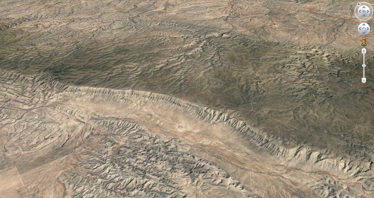
The Ridge is located in the Lincoln National Forest, Otero County, NM. This is a thermal and ridge-soaring site. In good conditions it is rated H2 /P2 with prior mountain experience; strong conditions H/P3. When thermals mix with the ridge lift use caution. It is the rim of a vast valley that runs about 20 miles NNW to SSE, and may be flown in wind directions ranging from SouthWest to due West. The soarable portion of the ridge is 11 miles long. Top landing is best. The valley below is flat and grass covered, the road in the valley is about 6:1 from launch.
If you land your PG in the valley, the hike up is a strenuous, steep 1400' slog. For HG landing below, the round trip retrieve drive via "El Paso Gap" from launch takes anywhere from 1.5 to 3 hours, depending on various factors such as your vehicle, how fast you are willing to drive, the condition of the road, severity of the washboards and if you are willing to go fast enough to "float" on them, etc.
The designated PG and HG launches are the most popular, but dozens and dozens of sites along the 20+ mile ridge will work.
The Guads Typically flown in mornings or late afternoons in winter. Thermals can mix with ridge lift mid-day and make for unpleasant conditions in the spring and summer, altough winter thermals are nice and can be used to get quite high over the ridge.
Camping is free, excellent and close to launch (32.2614743, -104.8945816). This is one of the darkest sites in the continental USA and that combined with the
6000’ elevation and dry air make the seeing unbelievably great. It's dark enough to see the Zodiacal light pre-dawn. The nearest town is Queen, where there is superb mobile phone service. Be sure to
stop in at the Queen Store and Cafe and order some food; the pies and burgers are particularly noteworthy. They know about the fly-in , and are
supportive. 575-981-2439
The Guads are popular
for campouts, and is very remote. Take lots of extra food, water and
gasoline. Sitting Bull Falls, a popular recreation site for swimming in
spring-fed pools, is a 2-hour drive from the launch site.
LZs
PG PILOTS - DO NOT TOP LAND BETWEEN 100 FEET AND 500 FEET BEHIND (EAST OF) THE TOP OF THE RIDGE! ROTOR!
Top landing at near the rim at launch is possible but it is not recommended for P2 pilots because of the rotor. P2 (or cautious) pilots should gain a minimum of 300’ (500' is best) and fly back to land in the designated HG LZ, which is well east of the camping area.
For a PG top landing at launch, do setup figure-8's over a spot 100' feet east of the launch. Do not allow yourself to get too far back - ROTOR DANGER. As you descend, time the turns so that the final turn to the west puts you about 50 feet up with a trajctory to touch down about 30 feet east of the ridge. If anything is not working, head west, go back up and try again.
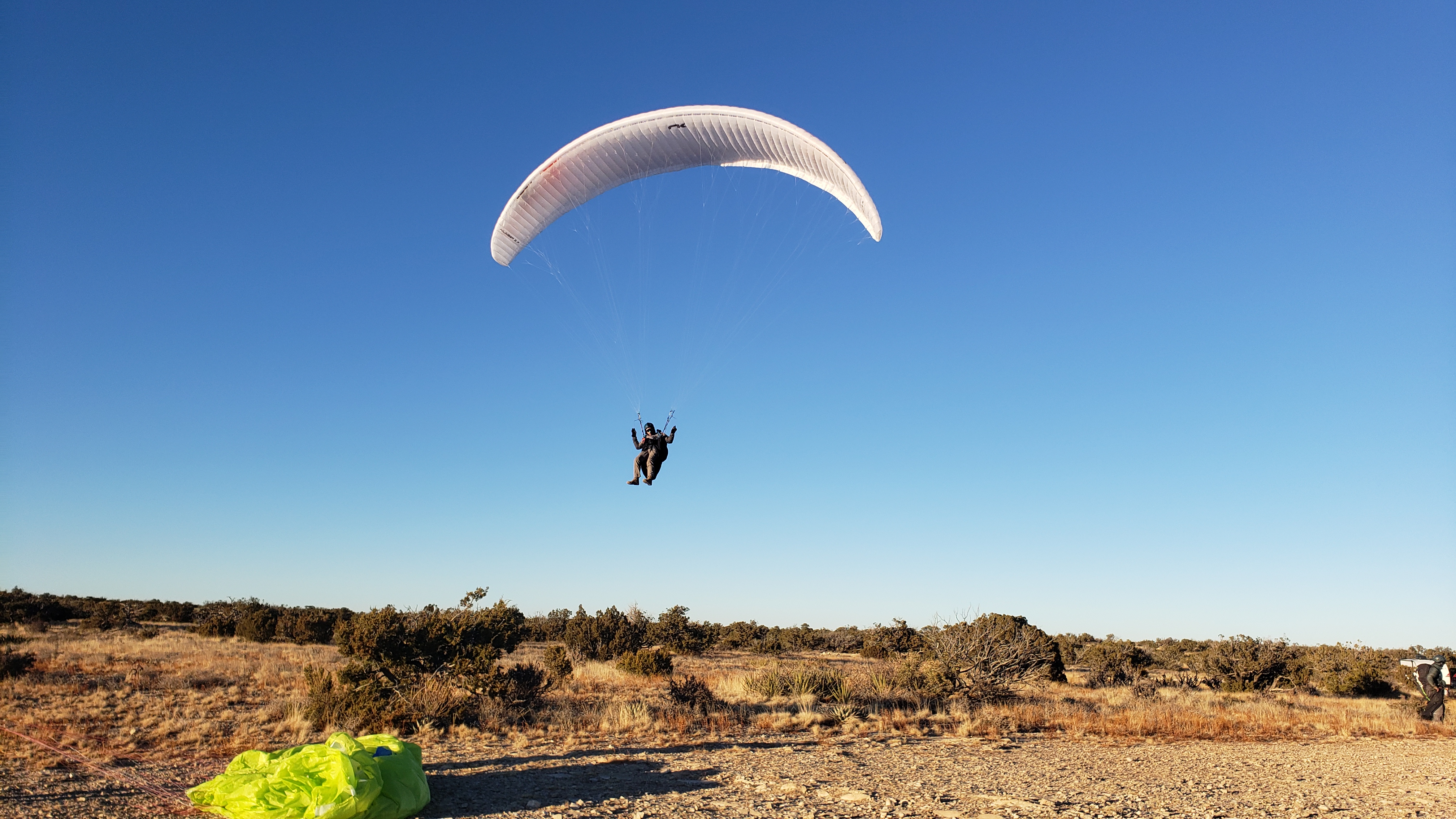 Max top landing at launch 2022 Presidents's day fly-in
Another option for PG is a side hill landing about 100’ below the PG launch. That slope is about 20 degrees and mostly free from rocks and cactus. The same slope can be used to launch in strong conditions, and should be used in winds 15-20 mph instead of the top launch area.
HG pilots typically land in the designated LZ east of the camping area. It has a nice approach and is reasonably free of trees and bushes.
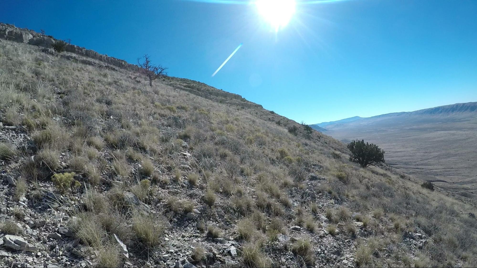
Hill below PG launch
If you are having trouble with any of the top landing methods, DO NOT TOP LAND! If you are sinking out and are unable to side-hill land (PG), pick a spot on the plains 1400' below, as close to the ridge
as possible. the hike up is a strenuous, steep 1400' slog, but you might find some deer trails. In-shape people can do the hike in an hour. Fat old pilots will struggle for 3+ hours (Steve Crye's advice). Bring water,
food, hiking poles and sun protection.
The valley below is flat
and grass covered, the road in the valley is about 6:1 from launch. For HG landing below, the round trip retrieve drive via "El Paso Gap" from launch takes anywhere from 1.5 to 3 hours, depending on various factors such as your vehicle, how fast you are willing to drive, the condition of the road, severity of the washboards and if you are willing to go fast enough to "float" on them, etc.
Directions to Launch
PG launch 32.2605710, -104.8963580
HG launch 32.2537955, -104.8933776
From US-180/US-62, turn onto Dark Canyon Road (408). Follow Dark Canyon 23 miles to NM-137 S. Follow NM-137 S for 23 miles though the town of Queen to CR 413 aka National Ranch Road (dirt) . Follow the dirt road 9.4 miles to launch/camping/LZ
Yes a Corolla can make it to launch!
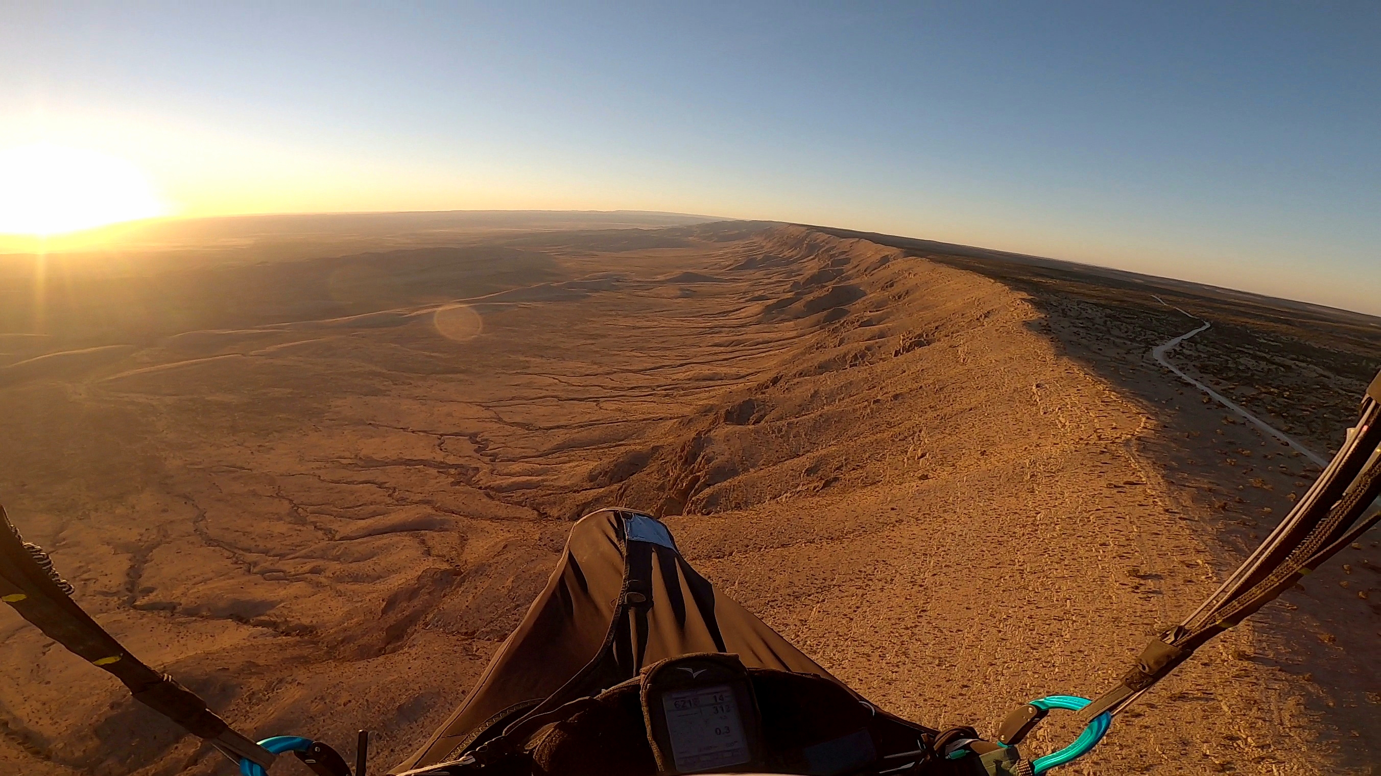
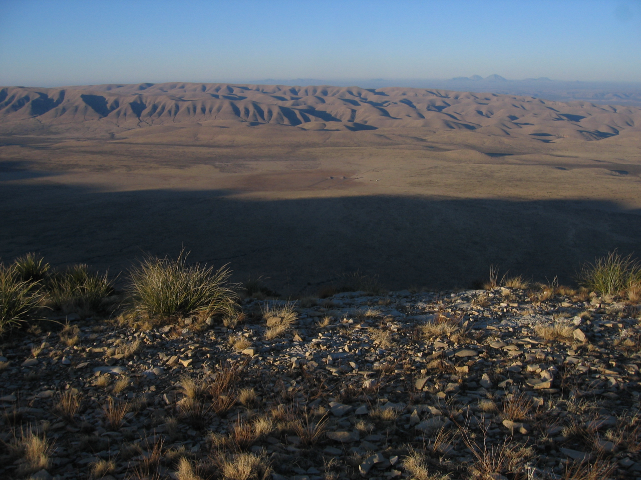 The view from HG launch looking west
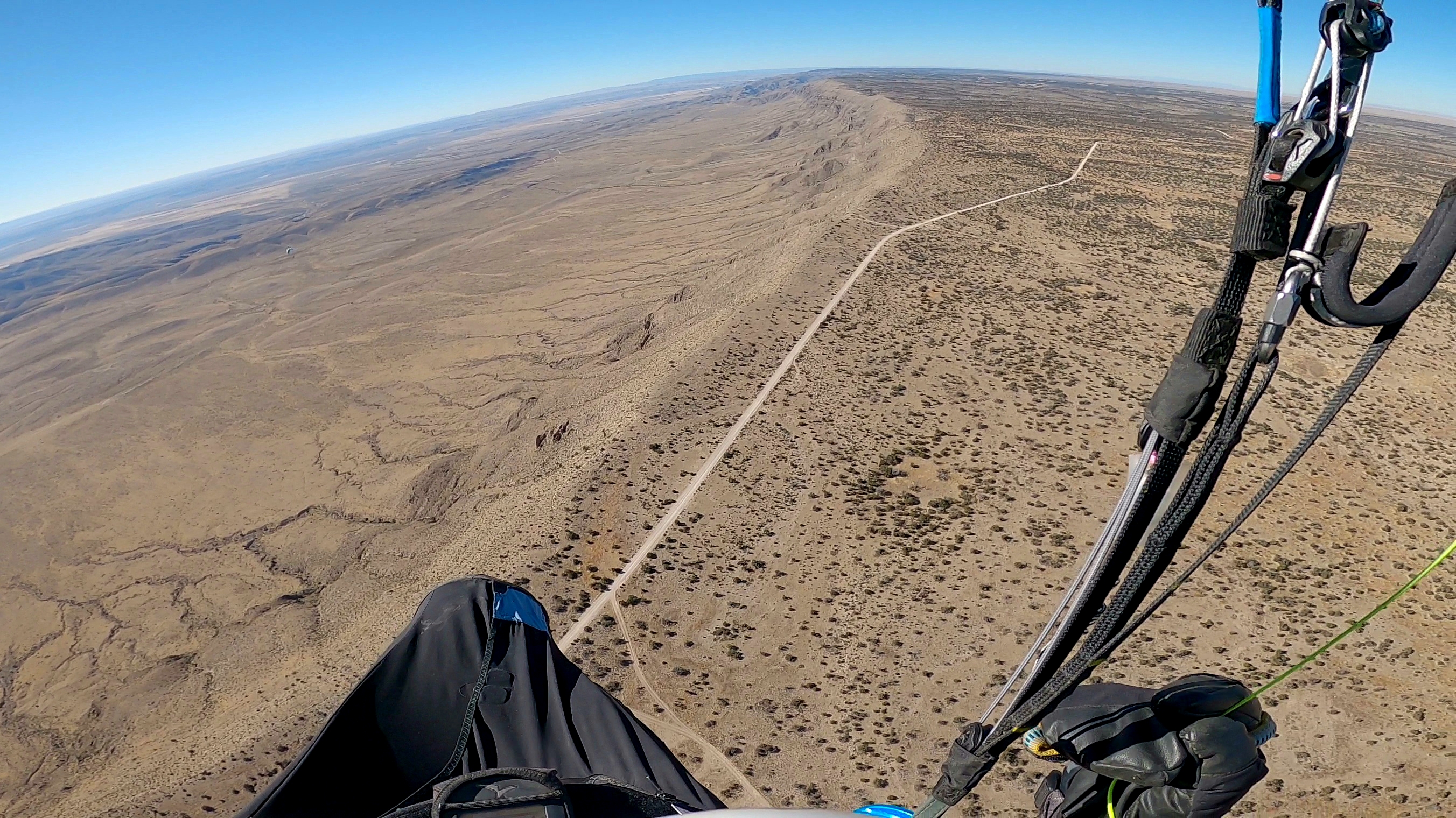
 Guadalupe Ridge looking north from HG launch
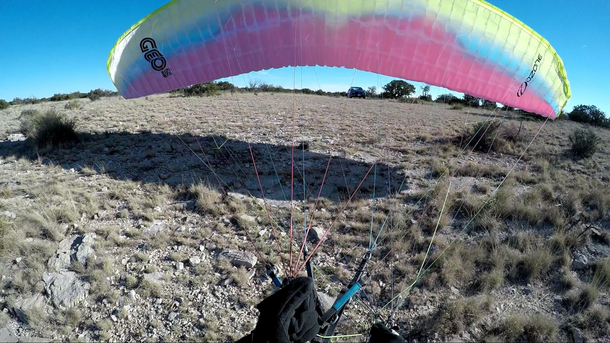
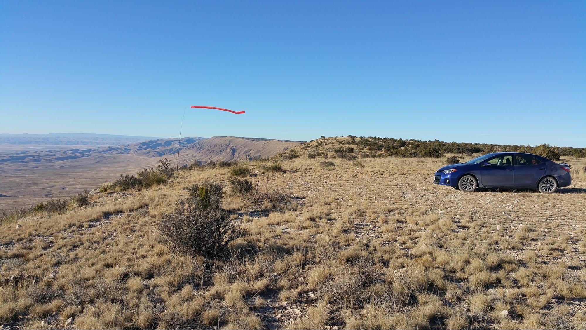
PG Launch, Winter 2016
The HG setup area can accommodate 50 gliders at once. The most commonly used launch is a dirt slope about 50 feet long, sloping down at 45 degrees. In winds of 20 mph or more, the site becomes turbulent, and a wire crew for HG becomes essential. This site can get very windy indeed, and blowouts are common. A sled run is typically 5 to 10 minutes in duration; soaring flights of several hours are also common.
 The 2008 Presidents Day RGSA fly-in at the Ridge
Wind and Conditions
When the winds at launch are more than 10 mph, the rotor behind launch extends from 100' behind the rim back to at LEAST 300' Don't mess with rotor! Look at the various Windy and XCskies models at 6000', 6400', 8000' and 10,000' Look at the big picture, and look at the trends - this site is USUALLY blown out, so timing is important. In the spring and summer thermals mixing with ridge lift can be very challenging. Best conditions are fall, winter and very early spring.
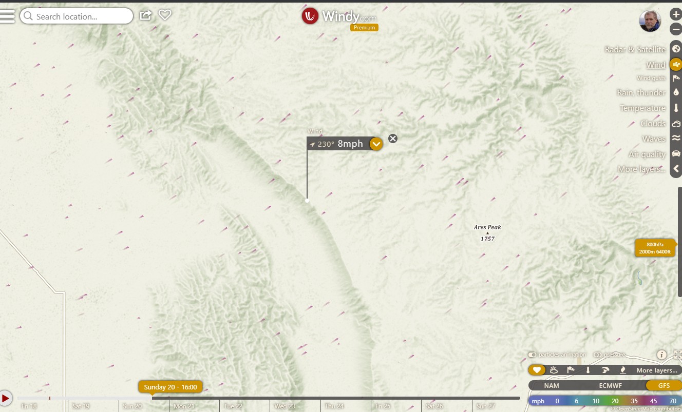
Ideal direction and speed in the forecast. Actual winds when forecast says 8 will be about 12. HRRR and NAM are more accurate than GFS for this site. Look at 6400, not surface on Windy.
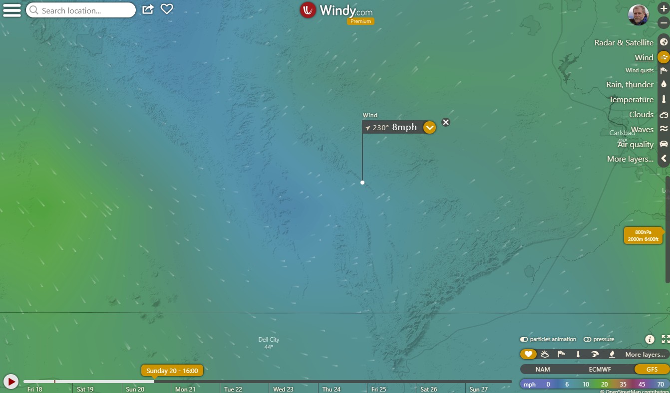 Ideal direction and speed in the forecast. Actualy winds when forecast says 8 will be about 12. NAM is more accurate then GFS.
In good conditions The Guads are a stunning and unique flying experience. Where else can 20 mile out and back XC be done via ridge-soaring?
2022 President's Day fly-in
 Thermalling about 1000' above launch, 2022 Presidents Day fly-in
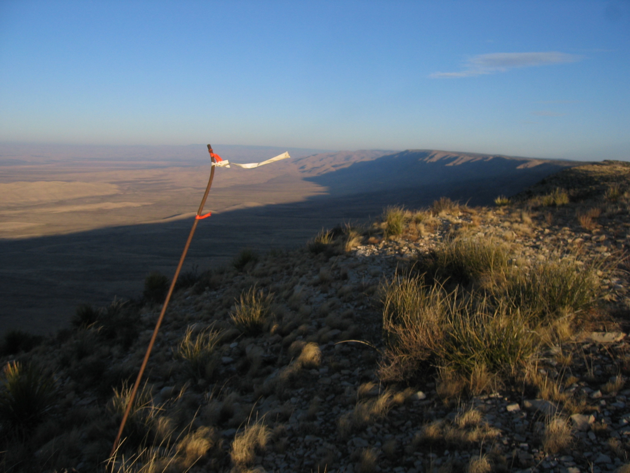
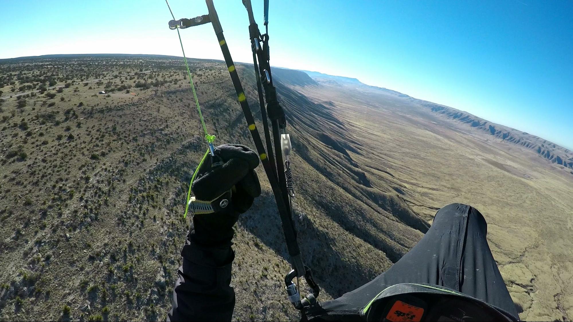 Looking south, Winter 2016. PG launch and windsock are visible above and right of the pilot's hand.
Because of the remote location, potential pressure to top land in dangerous conditions, rotor and numerous rocky ravines on the lower two thirds of the slope, pilots must have experience with top landing and mountain launches in strong conditions. A PG pilot was hurt in the rotor in December 2000.