East Potrillo Mountains Torrey Paso Launch
Revised 20260116
Doña Ana County, New Mexico
Torrey Paso launch 31.864917° -107.006817° 4,944' MSL 800' AGL
LZ 31.86905 -106.99456 Minimum Glide Ratio 5.9
Surface Winds ideal direction 70° - 80°, OK 65° - 110°, Min 5, ideal 9, Max 12 , gusts 5 mph.
Winds at 6k MSL no higher than 15 mph.
Rated P2, RS recommended
When flown during thermic times/dates, TURB recommended
Site Protocols / Rules
NOTE: The Riley Group mountains are now in a Wilderness area and all "mechanized" travel is prohibited. That includes LAUNCHING PG and HG. However, thanks to the efforts of Rod Burton, the East Potrillos and Torrey Paso launch was grandfathered in, and is still open. The regulations are silent with regard to landing, so as long as you launch from the East Potrillios, you need not worry about where you land. At the entrance to the LZ, you will see two BLM markers warning about no mechanized travel. It is permitted to park in the LZ. Do not attempt to drive up the jeep trail toward launch - it must be hiked the entire way.
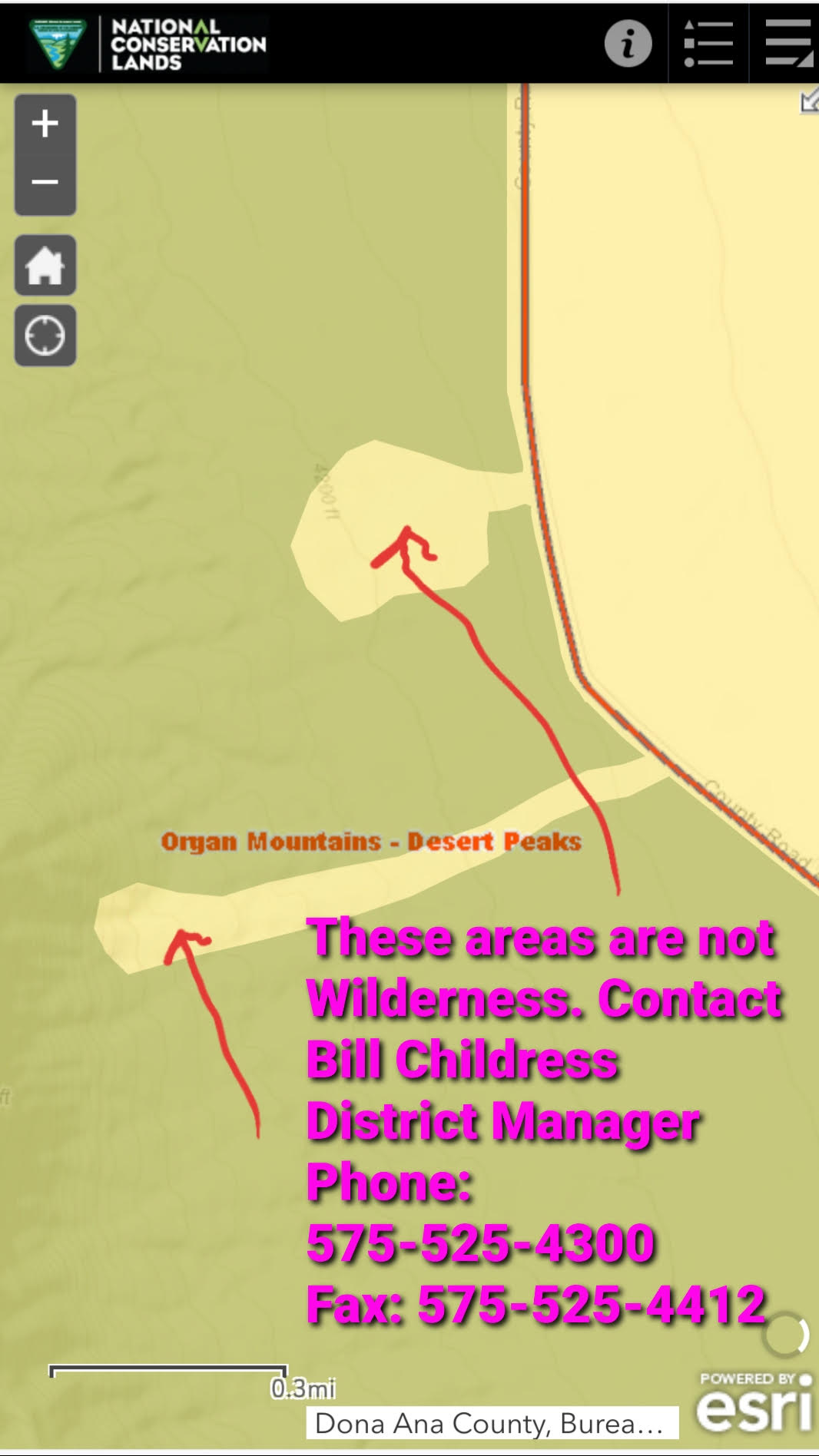
We suggest printing the above map and keeping it handy in case an uninformed BLM ranger tries to tell you the LZ is off limits.
Note: The Organ Mountains - Desert Peaks Conservation Act of the 115th Congress did not include any specific maps that delineated exactly where the East Potrillos section of the Wilderness Area is located. It is generally accepted that it is confined to the East Potrillo range, which is distinct from the rest of theWilderness area.
Key Site Safety Information:
Do not fly close to the terrain if there is any chance of turbulence caused by thermals.Lay your glider lines out carefully. Do not launch unless you are certain your glider lines are in order as pilots have inadvertently cut their lines pulling their gliders up.
Do NOT get low near launch as there is significant rotor and turbulence out front due to the fingers going out from the range.
General Info
It is one of only two east facing sites in the region that are soarable. It is now part of the Organ Mountains - Desert Peaks National Monument and was developed and first flown by PG pilots Lee Boone and Had Robinson. Informally rated P2. This range is (7) miles long and is located in south central New Mexico running SSE to NNW.
It is at least an hour of driving and 60 minutes of hiking to get to the launch area from Interstate 10 exit 8 so it is a good idea to know the conditions before heading out. The range can be flown in thermic conditions, according to your comfort and skill levels, but most paragliding instructors do not recommend soaring mountain ranges when thermals are strong. If you decide to thermal up, go out in front of the range, away from the ridge lift, to find a good thermal – there will always be plenty during most days.
LZ
The LZ is
large but somewhat overgrown, so leave as much clear space as possible for landing when you park. Near the end of the day (an hour
before sunset), the katabatic flow out of the mountains (like everywhere else in the
southwest) can be significant. Winds aloft and near
the surface can be 180 degrees different so be ready to land
going downwind. This means landing flares must be very deep and you
may have to run it out. Fortunately, the main LZ is fairly flat and, if
you have a wind sock planted, you should be able to land into the wind.
If you are tyring to soar the length of the range and bomb out, go as far as possible toward the road. The desert is fairly benign, mostly creosote.
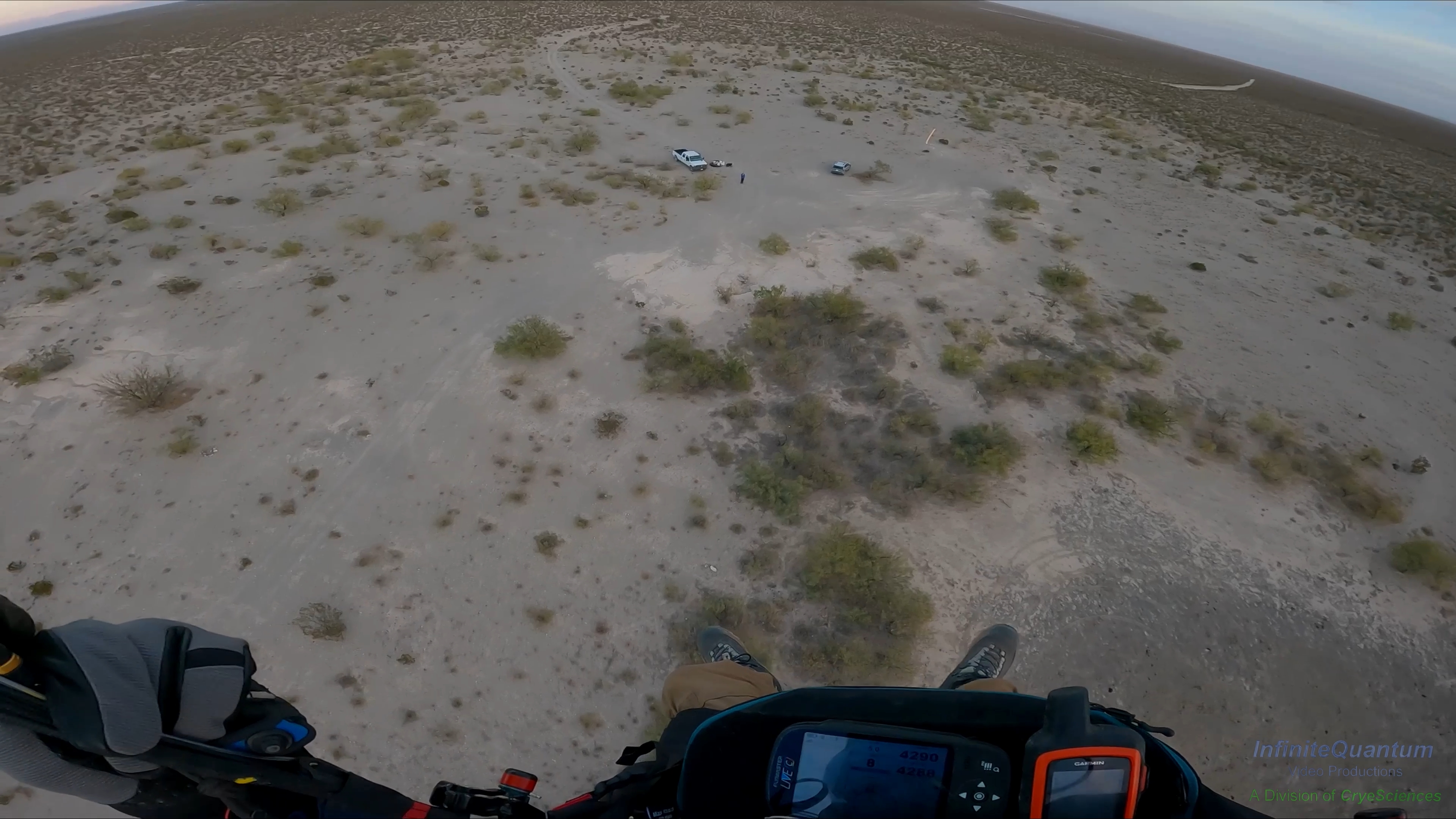
Steve Crye landing November 2023. Ed Armstrong and Rick Kieffer in LZ
Directions to Launch
Directions to the Torrey Paso launch. This site is off the grid and has intermittent cell service, depending on your carrier. Access to the Torrey Paso LZ does not require 4 wheel drive.
It is about a 45 minute hike to Torrey Paso launch from the LZ for in-shape people. Fat old people will struggle for 90 minutes. The actual launch area is at the south end of the saddle and in front where there is a small clearing.
About 100 feet below the main launch is an alternative launch just above a small shelf that can be used for a strong wind day. The alternate launch is unimproved and somewhat snaggy, but it works.
Winds and Conditions
Because of its orientation and slope, it is well suited for ridge soaring with winds from ESE to NE, especially in weak conditions. In laminar conditions, pilots can stay up in light winds if they stay close to the terrain. However, do not fly close to the terrain if there is any chance of turbulence caused by thermals. In the winter, on cloudy days, or late/early in the day the risk of turbulence is negligible. It is never good to fly when a strong Jet is overhead as gusting in the high desert can be severe and sudden if there is any chance of mixing due to the absence of an inversion between where we fly and the Jet. If a trough or some low pressure disturbance is going overhead, that can also cause the Jet to mix to the surface. Pilots have experienced the severe turbulence caused by this mixing. This is the high desert and conditions are unpredictable. You never really know what is going on until you arrive at launch. We continue to be amazed at how identical forecasts may make one day epic and another day dangerous. Of course, once up in winds aloft things are more predictable but we have to endure the conditions at launch, whatever they are. If you just wish to soar the range, here are some tips. The best time to avoid strong thermals is approximately 1.5 hours before sunset. At about 1 hour before sunset, conditions usually start to calm down and you will not be able to get up into the winds above the range (which do not change as a result of darkness). Sometimes, launch is raging and you will have to wait until dark for a sledder to the LZ.
If you have check HRRR, NAM and GFS models for 6K' MSL 1800 hrs. The more the models agree with each other, the better your chances of having good air. If the models show things dying at 1900 hours (summertime) launch early.
Be sure that the winds are easterly (70-130) at 6K' MSL and up to at least 10K' MSL or so. The more uniform the wind direction is going up, the calmer the air will be. What the winds are doing at 6K' MSL is the most important because that is the air forecast at launch and up and down the crest. Direction greater than SE means more turbulence at launch and less lift. Speeds less than 10 mph may make it hard to get up and stay up. If it's over 15 mph, getting blown over the back may happen. If there is a strong subsidence inversion above 8,000' MSL, this will help isolate the lower air mass from high winds aloft or Jet Stream turbulence if present.
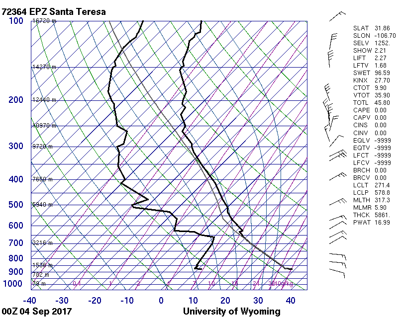
3. This recent skew-t and recent text list (Sept 3, 2017) show why that afternoon was perfect for soaring the range. However, the very next day, with similar soundings and forecasts, the air at launch was crazy – gusting in the 20's, going to zero, all over the place.
Additional info
In moderate conditions, the full range is flyable. In strong conditions, the lift band is over a 1/2 mile out in front.
In weaker conditions, pilots should turn immediately left (NNW) after launch, stay close to the terrain, and stay in the north end of The Bowl (the lift band which goes about 1/2 mile NNE). If you go further, you may sink out. Thermals from the fingers just north of launch wick their way up to the peak right above. The best thermals in these conditions are about 500' out in front of the peak.

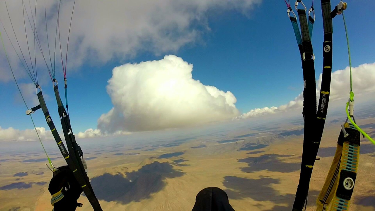
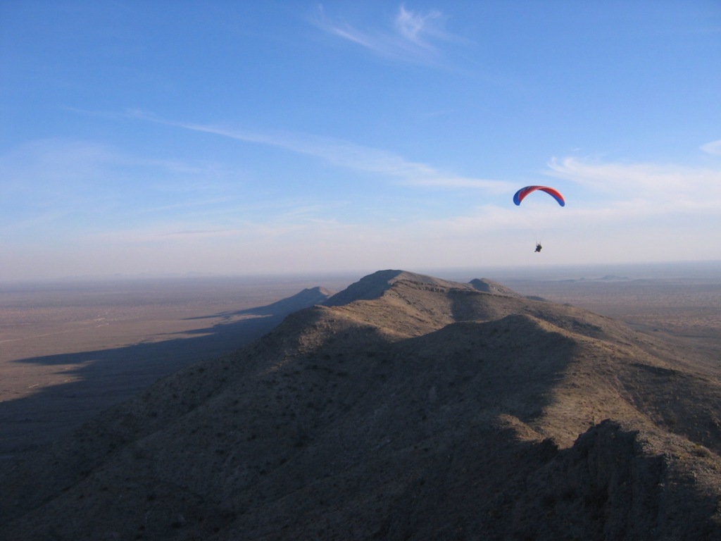
This was one of the days when you drop everything and go flying. Steve Crye follows a cloud street after launching from Torrey Paso and first to do it in this region. He is flying
northwest from the E. Potrillo Mountains on his way to Mt. Riley (the mountain in the foreground). Mt. No-name is just behind and Mt. Cox is to the left. Photo by
Steve.
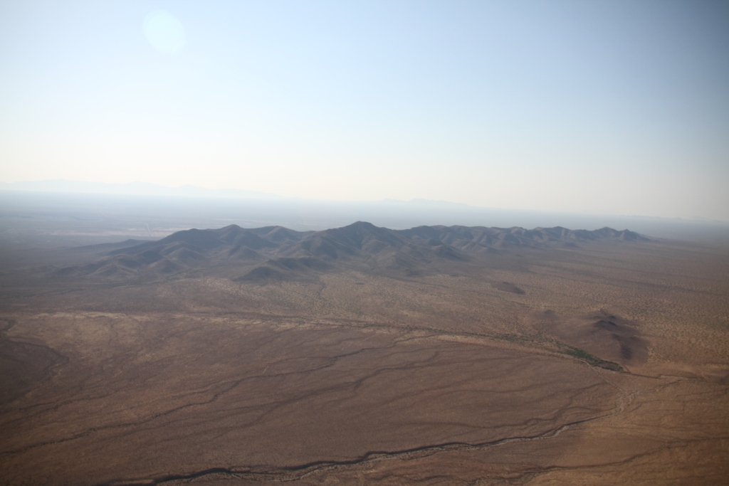 The East Potrillo Mountains – view looking southeast. Photo by
Glenn Tupper.
The East Potrillo Mountains – view looking southeast. Photo by
Glenn Tupper.
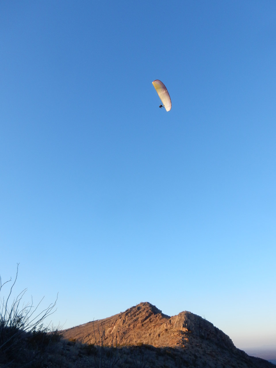
Jason Tilley soaring above Torrey Paso launch.
View south from
launch. Pilot is Lee Boone
Looking east from near the Torrey
Paso launch. In the far distance (32 miles away) are the Franklin
Mountains of El Paso. Lee just arrived at launch. Here
is the video
of his launch from Torrey Paso.
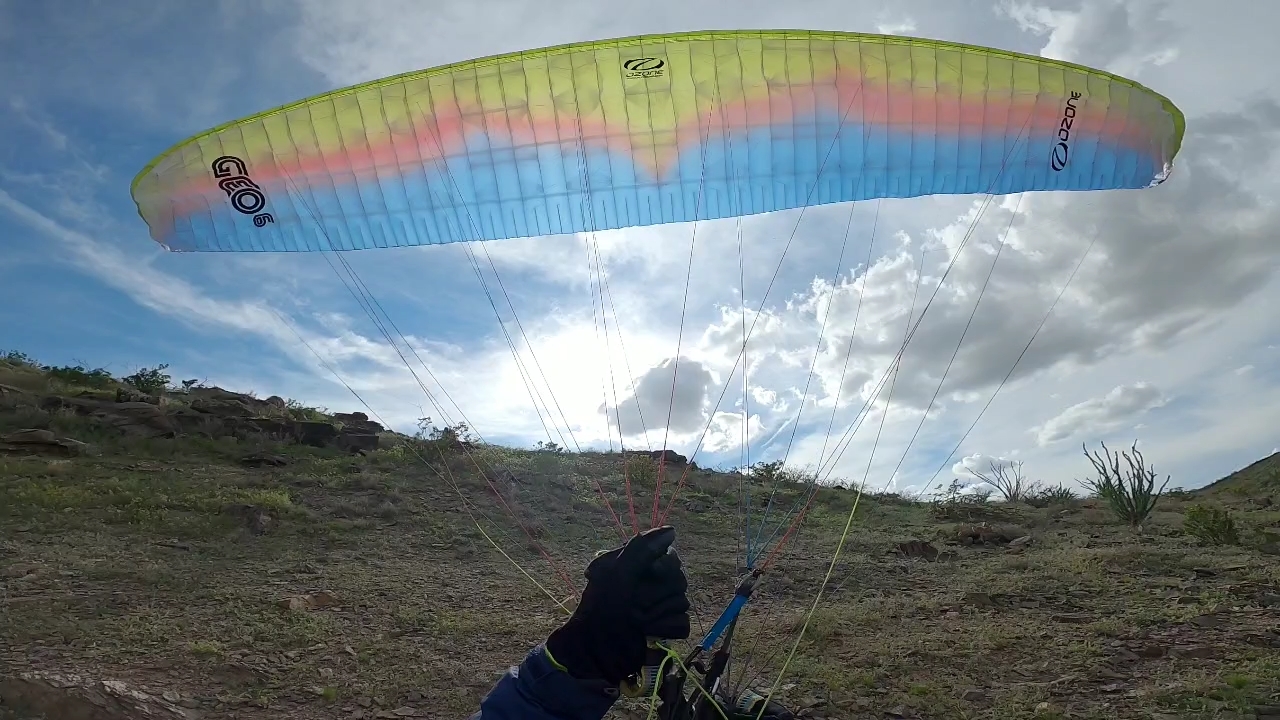 Steve Crye inflates his GEO6
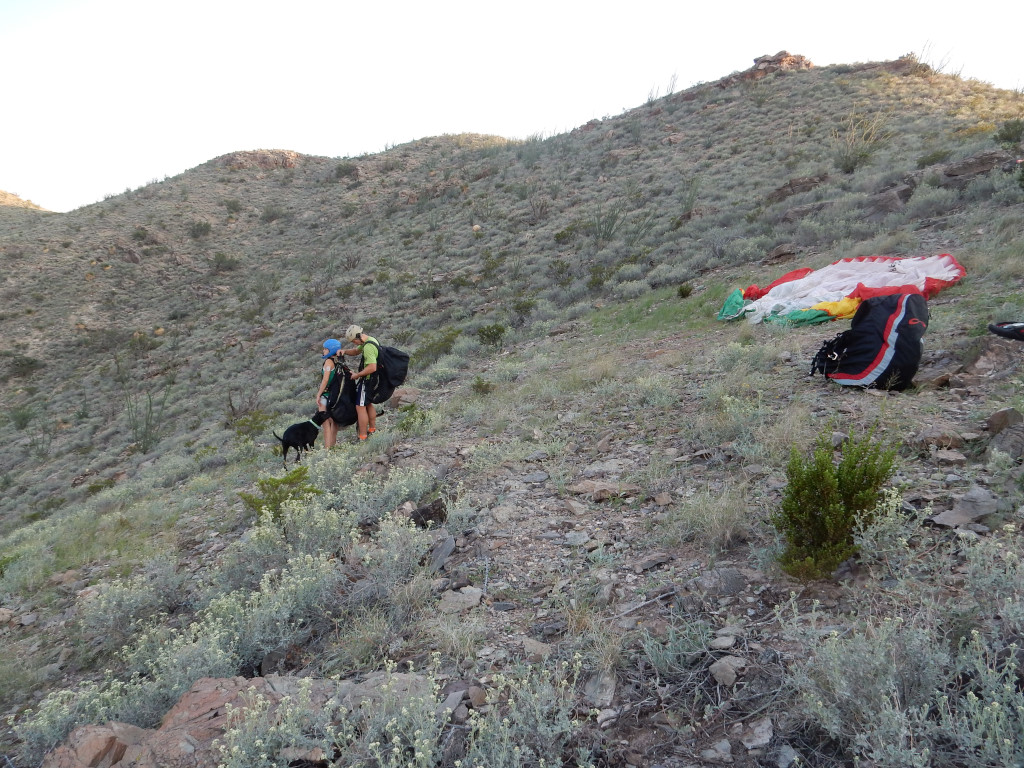
Nick and June Reiter are preparing to do the first tandem ever done in the East Potrillo Mountains. They had an epic flight.
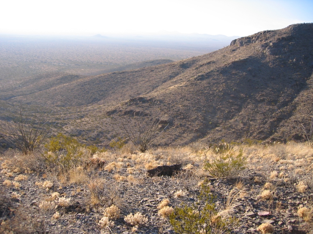
View west near launch. There are countless fingers running
out from the crest on the west face of these mountains which would make
flying the range with southwest winds difficult because of turbulence.
There are no roads running along the west face – you will have miles of
hiking if you land on this side of the range.
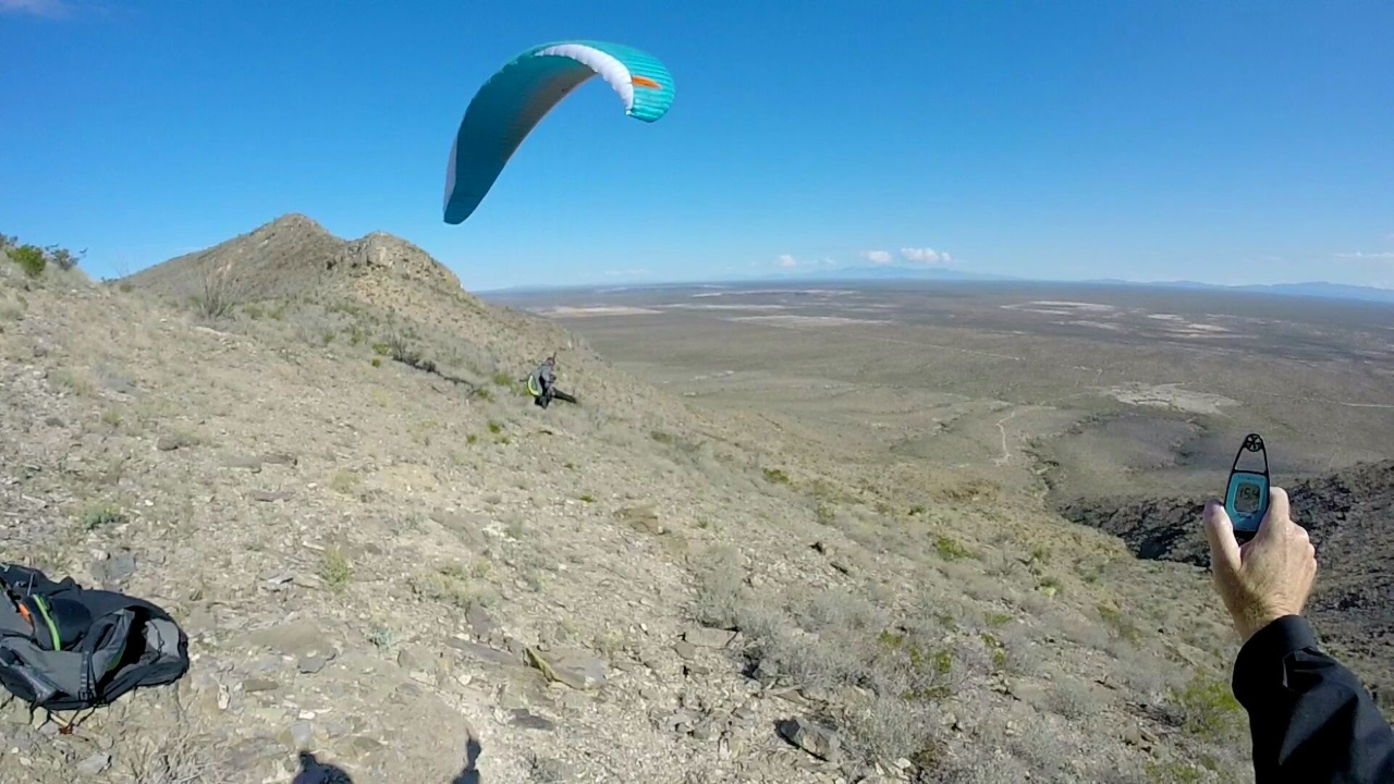
Max Montgomery launching from Torrey Paso launch. The launch is not sheer in front so pilots can safely abort a run. . When thermic conditions
were present,
Steve and Max proved that pilots can get away to the west and northwest, even
getting to the thermal goldmines in the Potrillo
Volcanic Field (15) miles northwest of the range.
Photo by Steve.